
IMAGES TAKEN NEAR TO
Wheatfield Place, EDINBURGH, EH11 2PF
Introduction
This page details the photographs taken nearby to Wheatfield Place, EH11 2PF by members of the Geograph project.
The Geograph project started in 2005 with the aim of publishing, organising and preserving representative images for every square kilometre of Great Britain, Ireland and the Isle of Man.

There are currently over 7.5m images from over14,400 individuals and you can help contribute to the project by visiting https://www.geograph.org.uk
Image Map
Images are licensed for reuse under creativecommons.org/licenses/by-sa/2.0
Notes
- Clicking on the map will re-center to the selected point.
- The higher the marker number, the further away the image location is from the centre of the postcode.
Image Listing (130 Images Found)
Images are licensed for reuse under creativecommons.org/licenses/by-sa/2.0
Image
Details
Distance


3

Wheatfield Place
Looking east towards Tynecastle Stadium.
Image: © Stephen Sweeney
Taken: 1 May 2010
0.05 miles
4

Railway bridges, Wheatfield Road
This connecting road between Gorgie and Murrayfield is a relatively unexplored corner of Edinburgh, but it made front-page news in early June 2012 when an outbreak of Legionnaire's disease was traced to industrial cooling towers on both sides of these bridges. Although the direct source of the bacterium was never positively identified, a total of 16 cooling towers belonging to different premises were chemically treated as an emergency measure, but not before two men had died after contracting the air-borne disease in the Gorgie area. At the peak of the outbreak the city's hospitals were treating 50 confirmed and 48 suspected cases, making a total of 98. This photograph was taken from the gate entrance to the North British Distillers Company two days before the outbreak was reported.
Image: © kim traynor
Taken: 2 Jun 2012
0.06 miles
5
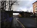
Wheatfield Road
A shopping trolley, no doubt part of the herd based at nearby Sainsbury's, roams the space between the two feeders of the Suburban Railway in Gorgie.
I am not sure what the most annoying spelling trap in English is, but the e in trolley has to be a contender. Waste of ink.
Image: © Richard Webb
Taken: 8 Feb 2016
0.07 miles
6

Blandfield Works, Wheatfield Road
When thinking of Edinburgh, pharmaceuticals probably doesn't spring to mind as one of the city's major industries, yet MacFarlan Smith has long been one of the major producers of fine chemicals for the whole of Britain. Its history goes back as far as the 1780s; and in the 1840s one of its main shareholders was the chemist whose company supplied Dr. James Young Simpson with the chloroform used in his anaesthetic experiments.
Image
Image: © kim traynor
Taken: 2 Jun 2012
0.07 miles
7

Blandfield Works
Between two railway chords at the west end of the Suburban Line.
Image: © Richard Webb
Taken: 8 Feb 2016
0.08 miles
8

A71 Gorgie Road, Edinburgh EH11
Towards the city centre.
Image: © Robin Webster
Taken: 17 Sep 2019
0.08 miles
9

Railway bridges, Wheatfield Road
With the Blandfield Works of Macfarlan Smith Ltd. on the left between the bridges and the main entrance to the North British Distillery Company just visible beyond the more distant bridge.
Image: © kim traynor
Taken: 2 Jun 2012
0.08 miles
10

Gorgie Road, Edinburgh
Looking east from the bottom of Wheatfield Road.
Image: © Stephen Sweeney
Taken: 1 May 2010
0.09 miles