
IMAGES TAKEN NEAR TO
Myrtle Terrace, EDINBURGH, EH11 1PF
Introduction
This page details the photographs taken nearby to Myrtle Terrace, EH11 1PF by members of the Geograph project.
The Geograph project started in 2005 with the aim of publishing, organising and preserving representative images for every square kilometre of Great Britain, Ireland and the Isle of Man.

There are currently over 7.5m images from over14,400 individuals and you can help contribute to the project by visiting https://www.geograph.org.uk
Image Map
Images are licensed for reuse under creativecommons.org/licenses/by-sa/2.0
Notes
- Clicking on the map will re-center to the selected point.
- The higher the marker number, the further away the image location is from the centre of the postcode.
Image Listing (332 Images Found)
Images are licensed for reuse under creativecommons.org/licenses/by-sa/2.0
Image
Details
Distance
2
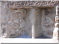
Old Milestone by the A70, Slateford Road, Edinburgh
Stone post by the A70, in parish of Edinburgh (City of Edinburgh District), Slateford Road, opposite Myrtle Terrace, in wall of Caledonian Brewery, North side of road.
Inscription once read:-
: (Edinburgh / 2) : : (Lanark / 30) :
Surveyed
Milestone Society National ID: CE_EDLK02
Image: © Milestone Society
Taken: Unknown
0.05 miles
3
Old milestone
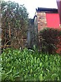
This is a view of the back of the 2 miles from Edinburgh stone on Slateford Road set into the wall surrounding the Caledonian Brewery. This stone would have had a metal plate round its two front edges with the legends, LANARK 30, EDINR 2. There are wooden plugs where the plate would have been fitted.
Image: © John Riddell
Taken: 1 May 2018
0.05 miles
4

Laying the new gas pipe in Slateford Road
Gas pipes are being relaid in Slateford Road. The work has disrupted traffic. The Caledonian Brewery can be seen in the background.
Image: © Sandy Gemmill
Taken: 1 Nov 2006
0.05 miles
5

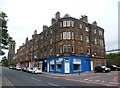
Slateford Colonies, Slateford Road
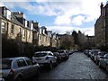
Terraced houses built by the Edinburgh Co-operative Building Company in the late-Victorian period. The terraces here are delightfully named after plants or trees: Primrose Terrace (1877), Ivy Terrace, closest to the camera, and Myrtle Terrace (1878), Laurel Terrace and Violet Terrace (1880), Daisy Terrace (1882) and Lily Terrace (1883).
Image: © kim traynor
Taken: 3 Sep 2011
0.05 miles
8
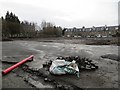
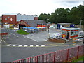
Land being redeveloped
Site of a big building off Slateford Road.
Image: © Richard Webb
Taken: 4 Jan 2014
0.05 miles
9
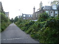
Site of Merchiston Station, off Harrison Place
The site of the Caledonian Railway Company's Merchiston Station which closed in 1965. It stood between Harrison Gardens and the Slateford colonies seen on the right. The track bed is now a pathway, but remains railway property. A platform is concealed by the vegetation on the right.
Image: © kim traynor
Taken: 19 Sep 2011
0.05 miles
10

Caledonian Brewery
Edinburgh was once famed for the number of its breweries, and this is one of a very small number still in existence.
Image: © Anne Burgess
Taken: 27 Sep 2011
0.05 miles