
IMAGES TAKEN NEAR TO
Swanston Drive, EDINBURGH, EH10 7BP
Introduction
This page details the photographs taken nearby to Swanston Drive, EH10 7BP by members of the Geograph project.
The Geograph project started in 2005 with the aim of publishing, organising and preserving representative images for every square kilometre of Great Britain, Ireland and the Isle of Man.

There are currently over 7.5m images from over14,400 individuals and you can help contribute to the project by visiting https://www.geograph.org.uk
Image Map
Images are licensed for reuse under creativecommons.org/licenses/by-sa/2.0
Notes
- Clicking on the map will re-center to the selected point.
- The higher the marker number, the further away the image location is from the centre of the postcode.
Image Listing (56 Images Found)
Images are licensed for reuse under creativecommons.org/licenses/by-sa/2.0
Image
Details
Distance
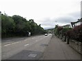
2
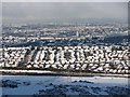
Swanston
Not the village associated with R.L. Stevenson but a 1980s infill housing estate by the city bypass.
Image: © Richard Webb
Taken: 28 Nov 2010
0.07 miles
3

Swanston
Along the Swanson Burn from the car park of the rather dull new outdoor shop that has been built on the site of the Fairmilehead Inn.
Image: © Richard Webb
Taken: 6 Dec 2015
0.08 miles
4

Swanston Avenue
Junction with Biggar Road.
Image: © Richard Webb
Taken: 9 Jun 2022
0.08 miles
5

Houses on Caiyside at Swanston
Looking across the site of the old Fairmile Inn, now demolished and being redeveloped.
Image: © M J Richardson
Taken: 12 Aug 2013
0.09 miles
6
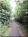
Path, Fairmilehead
Linking Winton Grove with the bus stop on Biggar Road.
Image: © Richard Webb
Taken: 9 Jun 2022
0.09 miles
7

Fairmile Inn
Long closed and boarded up.
Image: © Richard Webb
Taken: 19 Apr 2010
0.11 miles
8

Fairmile Inn
Currently closed and boarded up. The hill behind is Caerketton Hill.
Image: © Callum Black
Taken: 3 Feb 2007
0.11 miles
9

The site of the Fairmile Inn
Empty for 10 years Image, at last there is some action. It has been demolished and planning consent given by the City of Edinburgh Council for 'Mixed use development to include retail, offices, cafe/restaurant and ancillary workshop with adjoining residential flats all with associated car parking, revised access arrangements, ground level remodelling, landscaping and boundary treatment'. Seems to be quite a lot to replace what was a roadhouse. The Pentland Hills are beyond.
Image: © M J Richardson
Taken: 12 Aug 2013
0.11 miles
10
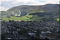
South from Buckstone Snab, Edinburgh
Looking across the grey roofs of Fairmilehead bungalows to Caerketton Hill, the Hillend ski slope and Lothianburn golf course.
Image: © Jim Barton
Taken: 14 Sep 2017
0.11 miles