
IMAGES TAKEN NEAR TO
Frogston Road West, EDINBURGH, EH10 7AH
Introduction
This page details the photographs taken nearby to Frogston Road West, EH10 7AH by members of the Geograph project.
The Geograph project started in 2005 with the aim of publishing, organising and preserving representative images for every square kilometre of Great Britain, Ireland and the Isle of Man.

There are currently over 7.5m images from over14,400 individuals and you can help contribute to the project by visiting https://www.geograph.org.uk
Image Map
Images are licensed for reuse under creativecommons.org/licenses/by-sa/2.0
Notes
- Clicking on the map will re-center to the selected point.
- The higher the marker number, the further away the image location is from the centre of the postcode.
Image Listing (27 Images Found)
Images are licensed for reuse under creativecommons.org/licenses/by-sa/2.0
Image
Details
Distance
1
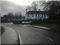
Margaret Rose Drive
The site of the Princess Margaret Rose Hospital, now housing. Some buildings from the hospital survived and are now residential.
Image: © Richard Webb
Taken: 31 Dec 2021
0.02 miles
2

Path off Margaret Road Drive
Used to access paths in woodland which surrounded the former hospital site.
Image: © Richard Webb
Taken: 30 Mar 2026
0.03 miles
3

Frogston Road West
The B701 at Fairmilehead. One of Edinburgh's subsidiary ring roads, with new housing on the site of what was the Princess Margaret Rose Hospital.
Image: © M J Richardson
Taken: 17 Sep 2008
0.04 miles
4
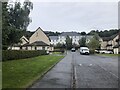
Margaret Rose Drive
The white building is probably the only survivor from the Princess Margaret Rose hospital.
Image: © Richard Webb
Taken: 15 Sep 2023
0.05 miles
5
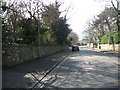
Winton Drive
A leafy street near Fairmilehead in Edinburgh.
Image: © James Denham
Taken: 19 Mar 2009
0.07 miles
6

Margaret Rose Walk
Houses built on the site of the Princess Margaret Rose Hospital.
Image: © Richard Webb
Taken: 31 Dec 2021
0.08 miles
7

22 Frogston Road West
If not well-versed in architecture you might expect the odd 'eyebrows' above the windows to be the most remarkable feature of this 1930s house. They do get mentioned in the listed building write-up by Historic Environment Scotland, but don't seem to warrant special attention. They are officially termed 'pantile hoodmounts' (pantile because they have the same profile as the S-shaped roof tiles of the same name), and are purely decorative. Generally these adornments don't look like eyebrows and protrude further from the wall, in order to act as a 'dripstone' and stop rain hitting or getting into a window or door.
The main reason the house - said to be inspired by both Hollywood and Spanish design - is listed, is that Basil Spence, often described as being from the Brutalist school of architecture, very probably had a hand in its planning. He was only about 27 at the time, however, and a junior partner in an architect practice - it was (and perhaps still is) common for the main partners to be credited with all the work, but HES reckon it's got some telltale giveaways somewhere.
Spence is most famous for designing the new Coventry Cathedral, built to replace the one destroyed by bombs in World War Two. In Scotland, he may be most famous for designing some high-rise flats in the Gorbals area of Glasgow in the 1960s, notable for being demolished by explosives in the 1990s, due in part to the levels of crime associated with them, and someone being killed in the explosion. In Edinburgh, where he studied and began his career, Mortonhall Crematorium is probably
his biggest work, though a group of rough-looking flats at the bottom of the Royal Mile is likely (and unfortunately - they are awful) the building of his seen by the most people.
In the Second World War Spence got mentioned in despatches a couple of times, took part in the D-day landings and, most interestingly, designed a fake oil depot somewhere around Dover. This was part of one of many intricate on-the-ground deception operations that took place in Britain towards the end of the war, and was actually a double deception, of sorts. The idea was to make the Germans think that there was a build-up of troops, weapons and vehicles at Dover in order to attack Calais (there was also similar stuff going on in Edinburgh, coincidentally, to make it look like an attack on Norway was imminent). The actual invasion was into Normandy, further West. So the hope was that the Germans would concentrate on protecting Calais and (the double deception bit), even when aware that Allied troops were landing on the beaches in Normandy, assume that this was an obvious deception to get them to move their manpower and firepower to the West, to leave Calais without adequate defences. Lots of lives were lost, and it is hard to gauge, without reading lots of big weighty books, how much was gained by the deception work, but it was ultimately a very successful mission.
Image: © Ian Dodds
Taken: 21 Apr 2026
0.09 miles
8

Margaret Rose Walk
Housing on the site of Princess Margaret Rose Hospital.
Image: © Richard Webb
Taken: 30 Mar 2026
0.11 miles
9
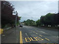
Bus stop on Frogston Road West (B701)
Looking south east.
Image: © JThomas
Taken: 6 Jul 2017
0.12 miles
10

Frogston Road West
Once a main route around Edinburgh, before the bypass it was busy again today with a 2km queue for the Kaimes traffic lights. The bus stop would once have served Princes Margaret Rose Hospital, now a residential area.
Image: © Richard Webb
Taken: 15 Sep 2023
0.13 miles