
IMAGES TAKEN NEAR TO
Pentland Gardens, EDINBURGH, EH10 6NN
Introduction
This page details the photographs taken nearby to Pentland Gardens, EH10 6NN by members of the Geograph project.
The Geograph project started in 2005 with the aim of publishing, organising and preserving representative images for every square kilometre of Great Britain, Ireland and the Isle of Man.

There are currently over 7.5m images from over14,400 individuals and you can help contribute to the project by visiting https://www.geograph.org.uk
Image Map
Images are licensed for reuse under creativecommons.org/licenses/by-sa/2.0
Notes
- Clicking on the map will re-center to the selected point.
- The higher the marker number, the further away the image location is from the centre of the postcode.
Image Listing (116 Images Found)
Images are licensed for reuse under creativecommons.org/licenses/by-sa/2.0
Image
Details
Distance
1
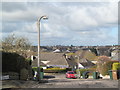
Period Lampposts in Pentland Gardens
The lampposts photographed date from the early 1950s. The fin-backed concrete brackets were removed from these columns later in 2019. Modern galvanised steel sleeves adorning LED light sources are now fitted.
Image: © Graeme Paterson
Taken: 2 Apr 2019
0.04 miles

3
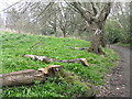
The end of the Cherry trees
Some of the cherry trees, planted in a trefoil pattern by the Girl Guides in 1935 to commemorate the Silver Jubilee of George V in 1935 have, after nearly 80 years, reached the end of their life. See also Image
Image: © M J Richardson
Taken: 6 Apr 2014
0.06 miles

5

Comiston Springs Avenue
Residential street with a view towards the Pentland Hills.
Image: © Richard Webb
Taken: 11 Jun 2008
0.07 miles

7

Cherry avenue, Braidburn Valley Park
The 1935 Jubilee trees have been replaced by younger ones on this path.
Image: © Richard Webb
Taken: 9 Jul 2020
0.07 miles
8

Comiston Wellhouse
Part of the infrastructure of Edinburgh's first piped water supply, this building appears to have fallen out of use. A view from the south can be seen in http://www.geograph.org.uk/photo/1609494 .
Image: © Alpin Stewart
Taken: 11 Mar 2017
0.08 miles
9
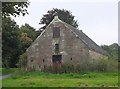
Old wellhouse at Oxgangs
A plaque on the opposite gable informs that this is an old wellhouse dating from around 1674, built as a cistern to collect water from springs in Comiston. It provided the city's first water supply.
Image: © Jim Barton
Taken: 22 Sep 2017
0.08 miles
10
Ivy taking over
One of a group of Poplars being overwhelmed by Ivy in Braidburn Valley Park.
Image: © M J Richardson
Taken: 21 Apr 2019
0.08 miles