
IMAGES TAKEN NEAR TO
Rattray Crescent, EDINBURGH, EH10 5TT
Introduction
This page details the photographs taken nearby to Rattray Crescent, EH10 5TT by members of the Geograph project.
The Geograph project started in 2005 with the aim of publishing, organising and preserving representative images for every square kilometre of Great Britain, Ireland and the Isle of Man.

There are currently over 7.5m images from over14,400 individuals and you can help contribute to the project by visiting https://www.geograph.org.uk
Image Map
Images are licensed for reuse under creativecommons.org/licenses/by-sa/2.0
Notes
- Clicking on the map will re-center to the selected point.
- The higher the marker number, the further away the image location is from the centre of the postcode.
Image Listing (59 Images Found)
Images are licensed for reuse under creativecommons.org/licenses/by-sa/2.0
Image
Details
Distance
1

Rattray Crescent
Housing on the site of the City Hospital for Infectious Diseases, later the City Hospital which closed in 1999. Greenbank is almost entirely surrounded by a stripwood and has few through routes, none at all by road.
Image: © Richard Webb
Taken: 2 May 2016
0.03 miles
2

Site of the City Hospital, Greenbank
Sandstone buildings from the City Hospital for Infectious Diseases which opened here in 1903. It later became the City Hospital and closed in 1999.
Image: © Richard Webb
Taken: 2 May 2016
0.05 miles
3

Woodland path
Heading east through a strip of woodland.
Image: © Callum Black
Taken: 5 Jan 2013
0.08 miles
4

Looking towards Littlejohn Wynd, Greenbank
The site of the City Hospital for Infectious Diseases, later the City Hospital which closed in 1999. Greenbank is almost entirely surrounded by a stripwood and has few through routes, none at all by road. This can be a problem for finding addresses as Greenbank Road is nearby but has only one short path (Ashy Path) connecting it to the modern Greenbank on the hospital site.
Image: © Richard Webb
Taken: 2 May 2016
0.09 miles
5

Little John Avenue
City Hospital redevelopment.
Image: © Richard Webb
Taken: 9 Oct 2022
0.09 miles
6
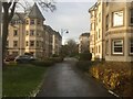
City Hospital site, Greenbank
Flats built to complement the converted hospital buildings nearby.
Image: © Richard Webb
Taken: 29 Nov 2021
0.09 miles
7
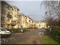
Rattray Drive
The former City Hospital site.
Image: © Richard Webb
Taken: 29 Nov 2021
0.10 miles
8
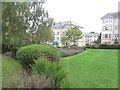
Play area, City Hospital site
The redeveloped former hospital still has extensive green spaces.
Image: © Richard Webb
Taken: 9 Oct 2022
0.11 miles
9

Woodland, Greenbank
The City Hospital was an isolation hospital for infectious diseases and was set in extensive parkland grounds. Much of the wooded area was preserved when the hospital site was redeveloped.
Image: © Richard Webb
Taken: 9 Oct 2022
0.12 miles
10

Rattray Drive
A mix of former hospital buildings and newer flats.
Image: © Richard Webb
Taken: 9 Oct 2022
0.12 miles