IMAGES TAKEN NEAR TO
Thaxton Place, LONDON, E4 7EQ
Introduction
This page details the photographs taken nearby to Thaxton Place, E4 7EQ by members of the Geograph project.
The Geograph project started in 2005 with the aim of publishing, organising and preserving representative images for every square kilometre of Great Britain, Ireland and the Isle of Man.

There are currently over 7.5m images from over14,400 individuals and you can help contribute to the project by visiting https://www.geograph.org.uk
Image Map
Images are licensed for reuse under creativecommons.org/licenses/by-sa/2.0
Notes
- Clicking on the map will re-center to the selected point.
- The higher the marker number, the further away the image location is from the centre of the postcode.
Image Listing (123 Images Found)
Images are licensed for reuse under creativecommons.org/licenses/by-sa/2.0
Image
Details
Distance
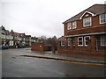
1
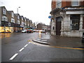
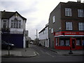
Station Road at the junction of Willow Street
Image: © David Howard
Taken: 20 Jan 2018
0.04 miles
2
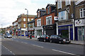
Station Road, Chingford
The name Station Road dates from 1878 when the railway was extended a short distance from its first Chingford terminus to a new one a little way to the east of this view. The railway transformed Chingford from an obscure rural village firstly into a resort for the masses visiting Epping Forest and then into a desirable commuter town with easy access to the City and development constrained by the forest to the north.
Image: © Stephen McKay
Taken: 4 Oct 2009
0.04 miles
4
Hovis sign, Station Road, Chingford
Image: © Jim Osley
Taken: 3 Feb 2016
0.05 miles
6
Station House Medical Centre, North Chingford
Image: © PAUL FARMER
Taken: 2 Jan 2011
0.07 miles
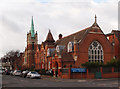
7
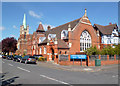
Chingford United Reformed Church
This splendid Edwardian church opened on May 19th 1910. Church history on http://www.chingfordurc.org.uk/history.html
Image: © Des Blenkinsopp
Taken: 15 Apr 2014
0.07 miles
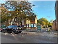
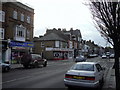
9
Cart Lane, North Chingford
The picture shows the junction with Station Road
Image: © PAUL FARMER
Taken: 2 Jan 2011
0.08 miles
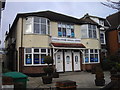
10
Spicer Hall, Chingford
Built in 1890 to the designs of architect Rowland Plumbe. Information extracted from: The Buildings of England. London 5: East. New Haven, London : Yale University Press, 2005, p. 717. Spicer Hall was originally used as a church and school: it is now in use as residential accommodation. More at this http://www.chingfordurc.org.uk/history.html.
Image: © Jim Osley
Taken: 3 Feb 2016
0.08 miles