IMAGES TAKEN NEAR TO
Thicknall Lane, STOURBRIDGE, DY9 0HN
Introduction
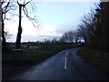
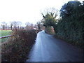
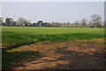
This page details the photographs taken nearby to Thicknall Lane, DY9 0HN by members of the Geograph project.
The Geograph project started in 2005 with the aim of publishing, organising and preserving representative images for every square kilometre of Great Britain, Ireland and the Isle of Man.

There are currently over 7.5m images from over14,400 individuals and you can help contribute to the project by visiting https://www.geograph.org.uk
Image Map
Images are licensed for reuse under creativecommons.org/licenses/by-sa/2.0
Notes
- Clicking on the map will re-center to the selected point.
- The higher the marker number, the further away the image location is from the centre of the postcode.
Image Listing (4 Images Found)
Images are licensed for reuse under creativecommons.org/licenses/by-sa/2.0
Image
Details
Distance
3
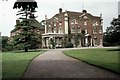
Field House Clent
This photograph was taken in 1965 when Field House was a Residential Children's Nursery run by Birmingham Corporation.
Image: © Annette Randle
Taken: Unknown
0.22 miles
4
Field House, Clent
Field house dates from the 18th century. It is now a rest home.
Image: © Philip Halling
Taken: 31 Mar 2007
0.23 miles