IMAGES TAKEN NEAR TO
The Meadows, STOURBRIDGE, DY9 0GW
Introduction
This page details the photographs taken nearby to The Meadows, DY9 0GW by members of the Geograph project.
The Geograph project started in 2005 with the aim of publishing, organising and preserving representative images for every square kilometre of Great Britain, Ireland and the Isle of Man.

There are currently over 7.5m images from over14,400 individuals and you can help contribute to the project by visiting https://www.geograph.org.uk
Image Map
Images are licensed for reuse under creativecommons.org/licenses/by-sa/2.0
Notes
- Clicking on the map will re-center to the selected point.
- The higher the marker number, the further away the image location is from the centre of the postcode.
Image Listing (13 Images Found)
Images are licensed for reuse under creativecommons.org/licenses/by-sa/2.0
Image
Details
Distance
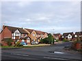
3
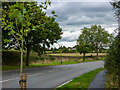
B4187, Worcester Lane between Hagley and Pedmore
This road (although it is called a Lane, it is a main road) passes through the last few fields that separate West Hagley from The West Midlands Conurbation. The trees look nice in their autumn colours
Image: © Richard Rogerson
Taken: 31 Oct 2010
0.09 miles
4
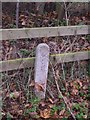
Water pipeline under Worcester Lane
This appears to be on the route of the Elan pipeline - though it is a very insignificant marker post for such a substantial pipe.
Image: © Simon Jobson
Taken: 22 Nov 2008
0.13 miles
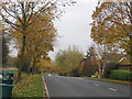
5
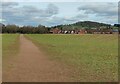
Path to Worcester Lane in Stourbridge
Wychbury Hill is on the horizon.
Image: © Mat Fascione
Taken: 9 Mar 2021
0.14 miles
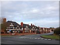
6
Worcester Lane, Hagley
This road leads from the Pedmore area to West Hagley. Several footpaths over the fields on the left lead to the village of Hagley.
Image: © Oliver Mills
Taken: 18 Sep 2022
0.14 miles
9
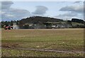
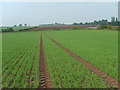
Farmland and tractor north of Hagley
With the backdrop of Wychbury Hill, 224 metres (735 feet).
Image: © Mat Fascione
Taken: 9 Mar 2021
0.18 miles
10
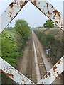
Railway Cutting
The line cuts through a hill on its way north to Stourbridge Junction. The view is from a footbridge on a footpath off Worcester Lane.
Image: © Gordon Griffiths
Taken: 27 Apr 2007
0.21 miles