
IMAGES TAKEN NEAR TO
Alwen Street, STOURBRIDGE, DY8 5YP
Introduction
This page details the photographs taken nearby to Alwen Street, DY8 5YP by members of the Geograph project.
The Geograph project started in 2005 with the aim of publishing, organising and preserving representative images for every square kilometre of Great Britain, Ireland and the Isle of Man.

There are currently over 7.5m images from over14,400 individuals and you can help contribute to the project by visiting https://www.geograph.org.uk
Image Map
Images are licensed for reuse under creativecommons.org/licenses/by-sa/2.0
Notes
- Clicking on the map will re-center to the selected point.
- The higher the marker number, the further away the image location is from the centre of the postcode.
Image Listing (205 Images Found)
Images are licensed for reuse under creativecommons.org/licenses/by-sa/2.0
Image
Details
Distance
2
Stourbridge Canal towards Stourbridge #10 Lock
Image: © Ian S
Taken: 4 Sep 2021
0.05 miles
3
Stourbridge Canal at Wordsley, Stourbridge
Ahead are some of the locks which are part of a flight of sixteen.
Image: © P L Chadwick
Taken: 29 Oct 2011
0.05 miles
4
Stourbridge Locks No 11 near Buckpool, Dudley
On the Stourbridge Canal, there are sixteen locks in the Stourbridge flight. They provide a rise (or fall) of 145 feet (44·2 metres).
Image: © Roger Kidd
Taken: 27 Aug 2010
0.05 miles
5
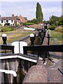
Lock Flight
The view of the Stourbridge canal sixteen locks near the Red House Cone.
Image: © Gordon Griffiths
Taken: 18 Aug 2011
0.05 miles
6

Stourbridge Canal - locks Nos. 11, 10 & 9
This is the Wordsley (Stourbridge) flight of 16 locks. No. 11 is closest. No.s 9 & 10 are very close to each other with a bridge between them. They are not a staircase as there are no shared gates but there is much less than a boat's length between them.
Image: © Chris Allen
Taken: 7 Oct 2019
0.05 miles
7
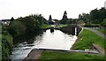
Narrowboat ascending the Stourbridge Sixteen
In the pound between locks 11 and 10.
Image: © Christine Johnstone
Taken: 3 Sep 2012
0.05 miles
8
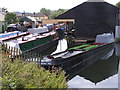
Dadford's Wharf
The view from the Stourbridge canal sixteen locks near the Red House Cone.
Image: © Gordon Griffiths
Taken: 18 Aug 2011
0.05 miles
9
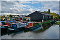
Wordsley : Stourbridge Canal - Dadford's Shed
Built between 1884 and 1903. The warehouse was named after Thomas Dadford Junior, the engineer who supervised the building of the Stourbridge Canal. Originally, it was used as a trans-shipment shed for the transfer of goods from road to water. In 1995 it became a boat-yard.
It is unusual as it was a canal /road interchange for Ivy Mills which was just along the road. It's an odd shaped ground plan to fit the restricted site. The covered canopy will allow two boats to be moored end to end. At one time it was used by the canal carrier Thomas Bantock who was the main carrier for the Great Western Railway and in this period the building was known as "The Railway Shed".
Image: © Lewis Clarke
Taken: 28 Sep 2019
0.05 miles
10
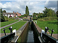
Stourbridge Locks No 11 near Buckpool, Dudley
Looking north-east at Lock No 11. Nos 10 and 9 can be seen ahead.
It is about half a mile to Leys Junction (with the Dudley No 1 Canal).
On the Stourbridge Canal, there are sixteen locks in the Stourbridge flight. They provide a rise (or fall) of 145 feet (44·2 metres).
Image: © Roger Kidd
Taken: 27 Aug 2010
0.05 miles