
IMAGES TAKEN NEAR TO
Harrison Road, STOURBRIDGE, DY8 5XB
Introduction
This page details the photographs taken nearby to Harrison Road, DY8 5XB by members of the Geograph project.
The Geograph project started in 2005 with the aim of publishing, organising and preserving representative images for every square kilometre of Great Britain, Ireland and the Isle of Man.

There are currently over 7.5m images from over14,400 individuals and you can help contribute to the project by visiting https://www.geograph.org.uk
Image Map
Images are licensed for reuse under creativecommons.org/licenses/by-sa/2.0
Notes
- Clicking on the map will re-center to the selected point.
- The higher the marker number, the further away the image location is from the centre of the postcode.
Image Listing (26 Images Found)
Images are licensed for reuse under creativecommons.org/licenses/by-sa/2.0
Image
Details
Distance
1
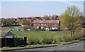
Parkland and houses near Buckpool, Dudley
Looking east across Swan Lane towards housing in Swanfield Road.
Image: © Roger Kidd
Taken: 4 Apr 2007
0.11 miles
2
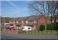
Modern housing near Buckpool, Dudley
This post-war new housing development in Swan Lane contrasts with the 1920s semis off to the right Image, and the mid 20th century estate off picture to the left. Image
Image: © Roger Kidd
Taken: 4 Apr 2007
0.14 miles
3
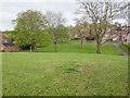
Green space off Swanfield Road
An open green space with grass and trees between Swanfield Road, where the photographer is standing, and Brambleside, the road in the distance.
Image: © David P Howard
Taken: 8 May 2013
0.14 miles
4
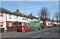
Semi-detached Houses, Hawbush Road, near Dudley
The semi-detached dwellings date from around the 1920s so there is insufficient space between them for garages or drives through to the rear. Consequently, parking is a problem.
Image: © Roger Kidd
Taken: 4 Apr 2007
0.17 miles
5
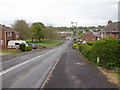
Swan Lane
View down Swan Lane from the junction with Fairfield Road.
Image: © David P Howard
Taken: 8 May 2013
0.17 miles
6
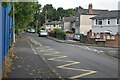
Bull Street, at the junction with Yorke Avenue
Image: © David Martin
Taken: 10 Sep 2022
0.19 miles
8
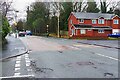
Brettell Lane, Amblecote, Stourbridge
Brettell Lane is here part of the A461 road. The road coming in from the left is Harrison Road. The house on the right is on Dennis Hall Road.
Image: © P L Chadwick
Taken: 11 Apr 2023
0.20 miles
9
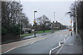
Brettell Lane
Heading towards Brierley Hill. Viewed in drizzle.
Image: © Bill Boaden
Taken: 2 Jan 2016
0.20 miles
10
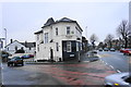
The Starving Rascal
One of Amblecote's several Good Beer Guide entries, on the corner of Collis Street and Brettell Lane.
Image: © Bill Boaden
Taken: 2 Jan 2016
0.21 miles