
IMAGES TAKEN NEAR TO
Muirville Close, STOURBRIDGE, DY8 5NR
Introduction
This page details the photographs taken nearby to Muirville Close, DY8 5NR by members of the Geograph project.
The Geograph project started in 2005 with the aim of publishing, organising and preserving representative images for every square kilometre of Great Britain, Ireland and the Isle of Man.

There are currently over 7.5m images from over14,400 individuals and you can help contribute to the project by visiting https://www.geograph.org.uk
Image Map
Images are licensed for reuse under creativecommons.org/licenses/by-sa/2.0
Notes
- Clicking on the map will re-center to the selected point.
- The higher the marker number, the further away the image location is from the centre of the postcode.
Image Listing (46 Images Found)
Images are licensed for reuse under creativecommons.org/licenses/by-sa/2.0
Image
Details
Distance
1
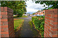
Wordsley : Muirville Close
Looking up Muirville Close from Lawnswood Road.
Image: © Lewis Clarke
Taken: 28 Sep 2019
0.02 miles
2
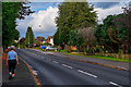
Kingswinford : Cot Lane
Looking along Cot Lane.
Image: © Lewis Clarke
Taken: 28 Sep 2019
0.05 miles
3
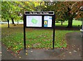
King George V Park - information board, Lawnswood Road, Wordsley, Stourbridge
Located by the shelter near the car park.
Part of this park is an independent charity and registered as a King George Field, which forms part of the National Memorial to King George V, who died in January 1936, and this land has to be preserved for public recreation.
Image: © P L Chadwick
Taken: 9 Nov 2013
0.05 miles
4
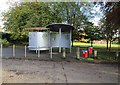
King George V Park - shelter & dog waste bins, Lawnswood Road, Wordsley, Stourbridge
Part of this park is an independent charity and registered as a King George Field, which forms part of the National Memorial to King George V, who died in January 1936, and this land has to be preserved for public recreation.
The shelter from the other side:- Image
The strange contraption seen in this view is a modern shelter with a bench seat on this side, and another on the other side. To the right are two red dog waste bins.
Image: © P L Chadwick
Taken: 9 Nov 2013
0.06 miles
5
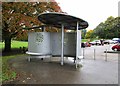
King George V Park - shelter, Lawnswood Road, Wordsley, Stourbridge
The shelter from the other side:- Image
Part of this park is an independent charity and registered as a King George Field, which forms part of the National Memorial to King George V, who died in January 1936, and this land has to be preserved for public recreation.
Image: © P L Chadwick
Taken: 9 Nov 2013
0.06 miles
6
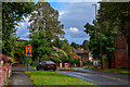
Wordsley : Lawnswood Road
Looking along Lawnswood Road as it approaches the junction with Cot Lane.
Image: © Lewis Clarke
Taken: 28 Sep 2019
0.06 miles
7
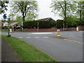
Mini Island
Between Lawnswood Road and Cot Lane.
Image: © Stephen Rogerson
Taken: 21 Apr 2017
0.06 miles
8
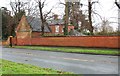
King George V Park - back of house at edge of park, Lawnswood Road, Wordsley, Stourbridge
Seen from Lawnswood Road. See also:- Image
Image: © P L Chadwick
Taken: 4 Jan 2014
0.07 miles
9
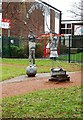
Sculpture outside Belle Vue Primary School, Lawnswood Road, Wordsley, Stourbridge
The sculpture shows a boy and a girl with a skipping rope, from which the word "Welcome" is attached. It is perhaps doubtful if many children today would know what a skipping rope is. Perhaps they ought to be holding a tablet computer instead?
Image
Image: © P L Chadwick
Taken: 4 Jan 2014
0.07 miles
10
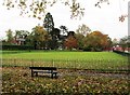
King George V Park - Crown Green Bowls green, Wordsley, Stourbridge
Another view of the green:- Image
Image: © P L Chadwick
Taken: 9 Nov 2013
0.08 miles