IMAGES TAKEN NEAR TO
Pineways, STOURBRIDGE, DY8 5JH
Introduction
This page details the photographs taken nearby to Pineways, DY8 5JH by members of the Geograph project.
The Geograph project started in 2005 with the aim of publishing, organising and preserving representative images for every square kilometre of Great Britain, Ireland and the Isle of Man.

There are currently over 7.5m images from over14,400 individuals and you can help contribute to the project by visiting https://www.geograph.org.uk
Image Map
Images are licensed for reuse under creativecommons.org/licenses/by-sa/2.0
Notes
- Clicking on the map will re-center to the selected point.
- The higher the marker number, the further away the image location is from the centre of the postcode.
Image Listing (17 Images Found)
Images are licensed for reuse under creativecommons.org/licenses/by-sa/2.0
Image
Details
Distance
1
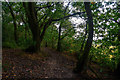
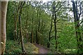
Kinver : Footpath
A footpath heads through the woodlands.
Image: © Lewis Clarke
Taken: 28 Sep 2019
0.13 miles
2
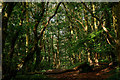
Kinver : Footpath
A footpath through the woodland.
Image: © Lewis Clarke
Taken: 28 Sep 2019
0.14 miles
3
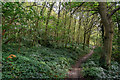
Kinver : Footpath
A footpath heading through the woodlands.
Image: © Lewis Clarke
Taken: 28 Sep 2019
0.15 miles
4
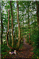
Kinver : Footpath
A footpath heads through the woods.
Image: © Lewis Clarke
Taken: 28 Sep 2019
0.16 miles
5
Kinver : Footpath
Looking along a footpath through the Kinver parish.
Image: © Lewis Clarke
Taken: 28 Sep 2019
0.16 miles
6
Path Junction
The Junction in Lawns Wood.
Image: © Gordon Griffiths
Taken: 14 Apr 2008
0.17 miles
7
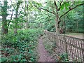
Woodland Path
The view of the path to Lawns Wood in Wordsley.
Image: © Gordon Griffiths
Taken: 8 Jul 2019
0.18 miles
8
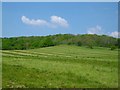
Mountpleasant Covert & Friars Gorse
Image: © Stephen Rogerson
Taken: 12 May 2016
0.19 miles
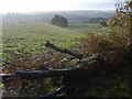
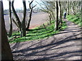
10
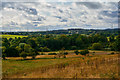
Kinver : Countryside Scenery
Looking out across the countryside.
Image: © Lewis Clarke
Taken: 28 Sep 2019
0.20 miles