IMAGES TAKEN NEAR TO
Hamilton Drive, STOURBRIDGE, DY8 5ET
Introduction
This page details the photographs taken nearby to Hamilton Drive, DY8 5ET by members of the Geograph project.
The Geograph project started in 2005 with the aim of publishing, organising and preserving representative images for every square kilometre of Great Britain, Ireland and the Isle of Man.

There are currently over 7.5m images from over14,400 individuals and you can help contribute to the project by visiting https://www.geograph.org.uk
Image Map (Loading...)


Getting Data...Please wait
Leaflet Map data © OpenStreetMap
Images are licensed for reuse under creativecommons.org/licenses/by-sa/2.0
Notes
- Clicking on the map will re-center to the selected point.
- The higher the marker number, the further away the image location is from the centre of the postcode.
Image Listing (25 Images Found)
Images are licensed for reuse under creativecommons.org/licenses/by-sa/2.0
Image
Details
Distance
1
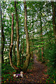
Kinver : Footpath
A footpath heads through the woods.
Image: © Lewis Clarke
Taken: 28 Sep 2019
0.17 miles
2
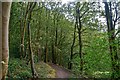
Kinver : Footpath
Looking along a footpath through the Kinver parish.
Image: © Lewis Clarke
Taken: 28 Sep 2019
0.18 miles
3
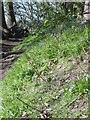
Bluebell Path
The Path through Lawns Wood.
Image: © Gordon Griffiths
Taken: 14 Apr 2008
0.19 miles
4
Path Junction
The Junction in Lawns Wood.
Image: © Gordon Griffiths
Taken: 14 Apr 2008
0.19 miles
5
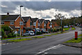
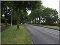
Wordsley : Balmoral Road
Looking along Balmoral Road off Lawnswood Road.
Image: © Lewis Clarke
Taken: 28 Sep 2019
0.19 miles
6
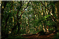
Kinver : Footpath
A footpath through the woodland.
Image: © Lewis Clarke
Taken: 28 Sep 2019
0.19 miles
7
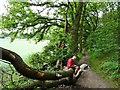
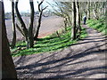
Tea Break Log
The view on the path through Lawns Wood near Wordsley.
Image: © Gordon Griffiths
Taken: 8 Jul 2019
0.19 miles
8
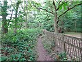
Woodland Path
The view of the path to Lawns Wood in Wordsley.
Image: © Gordon Griffiths
Taken: 8 Jul 2019
0.20 miles
10
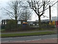
Belle Vue School
A Primary School off Lawnswood Road Wordsley.
Image: © Gordon Griffiths
Taken: 31 Mar 2007
0.21 miles