
IMAGES TAKEN NEAR TO
Ryder Street, STOURBRIDGE, DY8 5AT
Introduction
This page details the photographs taken nearby to Ryder Street, DY8 5AT by members of the Geograph project.
The Geograph project started in 2005 with the aim of publishing, organising and preserving representative images for every square kilometre of Great Britain, Ireland and the Isle of Man.

There are currently over 7.5m images from over14,400 individuals and you can help contribute to the project by visiting https://www.geograph.org.uk
Image Map
Images are licensed for reuse under creativecommons.org/licenses/by-sa/2.0
Notes
- Clicking on the map will re-center to the selected point.
- The higher the marker number, the further away the image location is from the centre of the postcode.
Image Listing (36 Images Found)
Images are licensed for reuse under creativecommons.org/licenses/by-sa/2.0
Image
Details
Distance
1
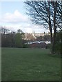
Wordsley View
The View towards Wordsley from the playing fields near Ashwood Park School.
Image: © Gordon Griffiths
Taken: 14 Apr 2008
0.21 miles
4
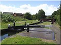
Top gate at Stourbridge Locks No 15 near Wordsley
On the Stourbridge Canal, there are sixteen locks in the Stourbridge flight. They provide a rise (or fall) of 145 feet (44·2 metres).
Image: © Roger Kidd
Taken: 27 Aug 2010
0.21 miles
5
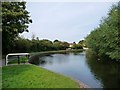
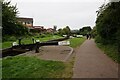
Stourbridge canal, above lock 15
The black and white structure on the towpath is designed to deter motorbikes.
Image: © Christine Johnstone
Taken: 3 Sep 2012
0.21 miles
6
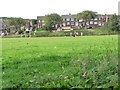
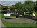
Playing footie near Kinver Street, Wordsley
Seen from lock 16 on the Stourbridge canal.
Image: © Christine Johnstone
Taken: 3 Sep 2012
0.21 miles
7
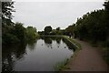
Stourbridge Canal towards Stourbridge #15 Lock
Image: © Ian S
Taken: 4 Sep 2021
0.21 miles
8
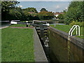
Stourbridge Locks No 15 near Wordsley, Dudley
On the Stourbridge Canal, there are sixteen locks in the Stourbridge flight. They provide a rise (or fall) of 145 feet (44·2 metres). Lock No 15 is seen here, looking north-east near Verity Walk (off to the right). A narrowboat has just passed through the lock, which has been drained to equalise water levels with the canal to the south-west.
Image]
Image]
Image: © Roger Kidd
Taken: 27 Aug 2010
0.21 miles
9
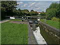
Stourbridge Locks No 15 near Wordsley, Dudley
On the Stourbridge Canal, there are sixteen locks in the Stourbridge flight. They provide a rise (or fall) of 145 feet (44·2 metres). Lock No 15 is seen here, looking north-east near Verity Walk (off to the right). Ground and gate paddles are up, and water is filling the chamber quite rapidly.
Image]
Image]
Image: © Roger Kidd
Taken: 27 Aug 2010
0.21 miles
10
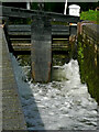
Filling the lock, near Wordsley, Dudley
This is lock No 15 in the Stourbridge flight of 16. The ground paddle was opened first, then the gate paddle raised causing a ferocious torrent of water into the lock chamber.
Image]
Image]
Image: © Roger Kidd
Taken: 27 Aug 2010
0.21 miles