IMAGES TAKEN NEAR TO
Kingsway, STOURBRIDGE, DY8 4TL
Introduction
This page details the photographs taken nearby to Kingsway, DY8 4TL by members of the Geograph project.
The Geograph project started in 2005 with the aim of publishing, organising and preserving representative images for every square kilometre of Great Britain, Ireland and the Isle of Man.

There are currently over 7.5m images from over14,400 individuals and you can help contribute to the project by visiting https://www.geograph.org.uk
Image Map
Images are licensed for reuse under creativecommons.org/licenses/by-sa/2.0
Notes
- Clicking on the map will re-center to the selected point.
- The higher the marker number, the further away the image location is from the centre of the postcode.
Image Listing (51 Images Found)
Images are licensed for reuse under creativecommons.org/licenses/by-sa/2.0
Image
Details
Distance
1
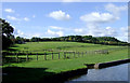
Canalside pasture north of Wollaston, Dudley
These extensive pastures by the Stourbridge Canal are partly sub-divided into paddocks for horse grazing.
Image: © Roger D Kidd
Taken: 28 Aug 2010
0.15 miles
2
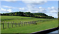
Horse pastures north of Wollaston, Dudley
These extensive pastures by the Stourbridge Canal are partly divided into large paddocks for horse grazing.
Image: © Roger D Kidd
Taken: 28 Aug 2010
0.15 miles
3
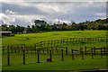
Kinver : Grassy Field
A grassy field in the parish of Kinver.
Image: © Lewis Clarke
Taken: 28 Sep 2019
0.15 miles
5
Kinver : Stourbridge Canal
Looking along the canal and towpath.
Image: © Lewis Clarke
Taken: 28 Sep 2019
0.17 miles
8
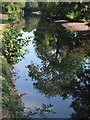
Stourbridge Canal near Wordesley Junction
This is one of a group of four images unusual in that the canal is less than half full, and a distinct sandy "beach" can be seen on the non towpath side. Two weeks ago a severe breach of the canal embankment occurred about 600 metres west of here, draining the channel completely. At present stop planks are in place under Bell's Mill Bridge, so a partial refill of the canal has taken place in this pound due to leakage from above Wordesley Junction (where stop planks have also been installed so that the Stourbridge Town arm could be rewatered).
Image: © Roger D Kidd
Taken: 21 Sep 2008
0.18 miles
9
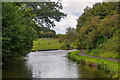
Wordsley : Stourbridge Canal
Looking along the canal and towpath.
Image: © Lewis Clarke
Taken: 28 Sep 2019
0.18 miles