
IMAGES TAKEN NEAR TO
Gilbanks Road, STOURBRIDGE, DY8 4RW
Introduction
This page details the photographs taken nearby to Gilbanks Road, DY8 4RW by members of the Geograph project.
The Geograph project started in 2005 with the aim of publishing, organising and preserving representative images for every square kilometre of Great Britain, Ireland and the Isle of Man.

There are currently over 7.5m images from over14,400 individuals and you can help contribute to the project by visiting https://www.geograph.org.uk
Image Map
Images are licensed for reuse under creativecommons.org/licenses/by-sa/2.0
Notes
- Clicking on the map will re-center to the selected point.
- The higher the marker number, the further away the image location is from the centre of the postcode.
Image Listing (13 Images Found)
Images are licensed for reuse under creativecommons.org/licenses/by-sa/2.0
Image
Details
Distance
1
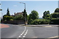
The former top of Meriden Avenue
The road used to go straight down to Wollaston, but has been blocked off.
Image: © Bill Boaden
Taken: 22 Jun 2018
0.10 miles
2
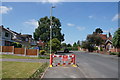
Closed footway on Meriden Avenue
Some work on the street lighting is required. The road has had a much more permanent closure ahead which has stopped it being a rat run.
Image: © Bill Boaden
Taken: 22 Jun 2018
0.11 miles
3
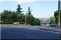
Cul-de-sac off Vicarage Road
The houses on the small housing development retain the numbering of Vicarage Road.
Image: © Bill Boaden
Taken: 22 Jun 2018
0.12 miles
4
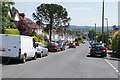
Meriden Avenue
Looking down the slope of this residential street towards the centre of Stourbridge.
Image: © Bill Boaden
Taken: 22 Jun 2018
0.15 miles
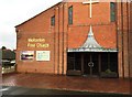
6
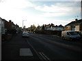
Vicarage Road, Wollaston (2)
Looking towards Stourton from the top of Wood Street.
Image: © Richard Vince
Taken: 20 Oct 2018
0.16 miles
7
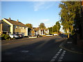
Vicarage Road, Wollaston (1)
Looking towards Amblecote from the top of Wood Street.
Image: © Richard Vince
Taken: 20 Oct 2018
0.19 miles
9
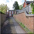
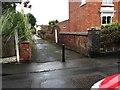
Laburnum Street alley
This short pedestrian alley way extension to Laburnum Street joins it to Wood Street.
Image: © David P Howard
Taken: 8 May 2013
0.21 miles
10
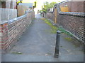
Laburnum Street, Wollaston (1)
This section, heading approximately east from Wood Street, is effectively a footpath.
Image: © Richard Vince
Taken: 20 Oct 2018
0.22 miles