IMAGES TAKEN NEAR TO
Burns Close, STOURBRIDGE, DY8 4NF
Introduction
This page details the photographs taken nearby to Burns Close, DY8 4NF by members of the Geograph project.
The Geograph project started in 2005 with the aim of publishing, organising and preserving representative images for every square kilometre of Great Britain, Ireland and the Isle of Man.

There are currently over 7.5m images from over14,400 individuals and you can help contribute to the project by visiting https://www.geograph.org.uk
Image Map
Images are licensed for reuse under creativecommons.org/licenses/by-sa/2.0
Notes
- Clicking on the map will re-center to the selected point.
- The higher the marker number, the further away the image location is from the centre of the postcode.
Image Listing (12 Images Found)
Images are licensed for reuse under creativecommons.org/licenses/by-sa/2.0
Image
Details
Distance
6
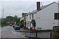
Collis Street, Amblecote
Looking down Collis street at its junction with Villa Street on a wet and thoroughly miserable Sunday afternoon.
Image: © Stephen McKay
Taken: 12 Jun 2011
0.22 miles
7
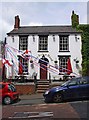
The Robin Hood (1), 196-200 Collis Street, Amblecote, Stourbridge
A popular pub with a claim to fame, as it was the first pub to receive a delivery of a cask of the wonderful Enville Ales, when the brewery opened in 1993. The bunting outside was probably connected with the Euro 2012 football matches, and the recent celebration of H.M. Queen Elizabeth II's Diamond Jubilee.
Image
Image
Image: © P L Chadwick
Taken: 23 Jun 2012
0.22 miles
8
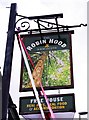
The Robin Hood (2) - sign, 196-200 Collis Street, Amblecote, Stourbridge
The sign instead of having the usual picture showing the famous outlaw Robin Hood depicts a tree, presumably in Sherwood Forest in Nottinghamshire. This is the place most often linked with Robin Hood, but he has also been placed in Yorkshire and elsewhere.
Image
Image
Image: © P L Chadwick
Taken: 23 Jun 2012
0.22 miles
9
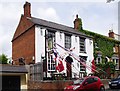
The Robin Hood (3), 196-200 Collis Street, Amblecote, Stourbridge
Image: © P L Chadwick
Taken: 23 Jun 2012
0.22 miles