
IMAGES TAKEN NEAR TO
Old Wharf Road, DY8 4FN
Introduction
This page details the photographs taken nearby to Old Wharf Road, DY8 4FN by members of the Geograph project.
The Geograph project started in 2005 with the aim of publishing, organising and preserving representative images for every square kilometre of Great Britain, Ireland and the Isle of Man.

There are currently over 7.5m images from over14,400 individuals and you can help contribute to the project by visiting https://www.geograph.org.uk
Image Map
Images are licensed for reuse under creativecommons.org/licenses/by-sa/2.0
Notes
- Clicking on the map will re-center to the selected point.
- The higher the marker number, the further away the image location is from the centre of the postcode.
Image Listing (222 Images Found)
Images are licensed for reuse under creativecommons.org/licenses/by-sa/2.0
Image
Details
Distance
1
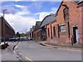
Old Wharf Road
The view near the canal in Stourbridge.
Image: © Gordon Griffiths
Taken: 25 Aug 2012
0.04 miles
2
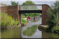
Neville Garratt Bridge, Stourbridge Canal
The last bridge on the Stourbridge Town Arm is this attractive rebuilt footbridge. Neville Garratt was a Black Country businessman, although why this bridge should be named after him is unclear.
Image: © Stephen McKay
Taken: 30 Jul 2008
0.05 miles
3
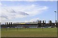
West Stand at Stourbridge Football Club, War Memorial Athletic Ground, Amblecote, Stourbridge
For more information about the Football Club
and a link to the Stourbridge Cricket Club … see …
Image
For more views … see …
Image
Image
Image
Image
Image: © Terry Robinson
Taken: 13 Feb 2014
0.05 miles
4
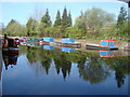
Stourbridge Canal Basin
Viewed from beside the bonded warehouse in Canal Street this is the terminal basin of the Stourbridge Canal
Image: © Rob Newman
Taken: 10 Apr 2011
0.05 miles
5
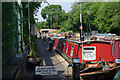
Narrowboats at Stourbridge
The original purpose of the Stourbridge Canal was to link collieries in the Dudley area with the glass-making factories at Stourbridge. By also linking with the Staffordshire & Worcestershire Canal at Stourton the canal was also able to offer an outlet for Dudley coal to the River Severn. The enterprise remained profitable until at least the 1930s, but in common with the rest of the narrow canal network suffered severe decline thereafter and was effectively abandoned by the 1960s. It was, however, restored and reopened for leisure craft in 1967. Here, at the end of the 2-mile arm into the centre of Stourbridge, there are moorings for privately owned narrowboats.
Image: © Stephen McKay
Taken: 8 Jun 2008
0.05 miles
6
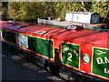
Cornelian Mooring
The view at the 2018 Stourbridge Canal Festival.
Image: © Gordon Griffiths
Taken: 20 Oct 2018
0.05 miles
7
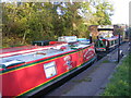
White Locks
The view at the 2018 Stourbridge Canal Festival.
Image: © Gordon Griffiths
Taken: 20 Oct 2018
0.05 miles
9
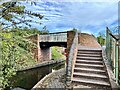
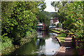
Footbridge over the Stourbridge Canal
Bridge inscribed John Bradley and Co, Stourbridge. A.D. 1838.
Image: © Andrew Abbott
Taken: 16 Oct 2022
0.05 miles
10
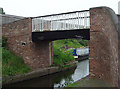
Neville Garrett Bridge, Stourbridge
Cast by James Bradley, Stourbridge, 1838
Image: © Alan Murray-Rust
Taken: 14 May 2006
0.05 miles