
IMAGES TAKEN NEAR TO
Batchelor Close, STOURBRIDGE, DY8 4AX
Introduction
This page details the photographs taken nearby to Batchelor Close, DY8 4AX by members of the Geograph project.
The Geograph project started in 2005 with the aim of publishing, organising and preserving representative images for every square kilometre of Great Britain, Ireland and the Isle of Man.

There are currently over 7.5m images from over14,400 individuals and you can help contribute to the project by visiting https://www.geograph.org.uk
Image Map
Images are licensed for reuse under creativecommons.org/licenses/by-sa/2.0
Notes
- Clicking on the map will re-center to the selected point.
- The higher the marker number, the further away the image location is from the centre of the postcode.
Image Listing (51 Images Found)
Images are licensed for reuse under creativecommons.org/licenses/by-sa/2.0
Image
Details
Distance
1
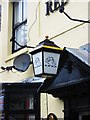
The Red Lion (3) - lamp, 147 Brettell Lane, Amblecote, Stourbridge
This is one of the Banks's houses which has retained a lamp with the Banks's lion, over its front door. Possibly, in late Victorian times, they were lit by gas.
Image
Image
Image: © P L Chadwick
Taken: 5 Jun 2012
0.11 miles
2
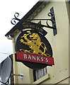
The Red Lion (2) - sign, 147 Brettell Lane, Amblecote, Stourbridge
The sign follows the normal design for Banks's houses, with its golden lion.
The Red Lion remains the most common name given to public houses. The name derives from King James VI of Scotland, who inherited the English throne in 1603, on the death of Queen Elizabeth I. He became King James I of England, and to reinforce his authority to rule, he decreed that all public buildings (including taverns) must display a heraldic red lion in a prominent position. This resulted in many pubs acquiring the Red Lion name. Judging by its appearance, this particular Red Lion pub almost certainly wasn't around in the 17th century, but the tradition of giving this name to pubs seems to have carried on for a long time. According to The Inn Sign Society's website, there are thought to be about 600 Red Lion pubs still in business, and over the years many of the same name have closed.
Image
Image
Image: © P L Chadwick
Taken: 5 Jun 2012
0.11 miles
3
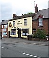
The Red Lion (1), 147 Brettell Lane, Amblecote, Stourbridge
The town of Stourbridge has several pubs called the Red Lion within its various districts. This one is at Amblecote and is a Banks's house. Next door on the left is a computer services shop. This belonged to the same brewery as the pub and was in use as a private house, when planning permission was given in 1991 to convert it to retail premises and offices.
Image
Image
Image: © P L Chadwick
Taken: 5 Jun 2012
0.11 miles
4
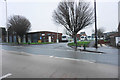
The Unicorn Centre
A resource centre for adults with learning disabilities operated by Dudley MBC. Vale Street has been incorporated into the site.
Image: © Bill Boaden
Taken: 2 Jan 2016
0.13 miles
5
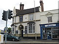
The Maverick Public House, Amblecote
Image: © Richard Rogerson
Taken: 4 Jul 2010
0.15 miles
6
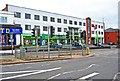
York House, 9-12 High Street, Amblecote, Stourbridge
York House is rather an unusual building with a central balcony at first floor level and rather an art deco appearance. Much of the ground floor is taken up by the floor covering retail shop of Kidderminster Carpets. Other businesses are based there too and some space was available to rent.
Image: © P L Chadwick
Taken: 5 Jun 2012
0.15 miles
8
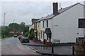
Collis Street, Amblecote
Looking down Collis street at its junction with Villa Street on a wet and thoroughly miserable Sunday afternoon.
Image: © Stephen McKay
Taken: 12 Jun 2011
0.16 miles
9

Platts Crescent at the junction of High Street, Amblecote
Image: © David Howard
Taken: 3 Jun 2018
0.16 miles
10
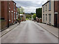
Villa Street
View SSE down Villa Street towards the junction with Collis Street.
Image: © David P Howard
Taken: 8 May 2013
0.16 miles