
IMAGES TAKEN NEAR TO
The Broadway, STOURBRIDGE, DY8 3JD
Introduction
This page details the photographs taken nearby to The Broadway, DY8 3JD by members of the Geograph project.
The Geograph project started in 2005 with the aim of publishing, organising and preserving representative images for every square kilometre of Great Britain, Ireland and the Isle of Man.

There are currently over 7.5m images from over14,400 individuals and you can help contribute to the project by visiting https://www.geograph.org.uk
Image Map
Images are licensed for reuse under creativecommons.org/licenses/by-sa/2.0
Notes
- Clicking on the map will re-center to the selected point.
- The higher the marker number, the further away the image location is from the centre of the postcode.
Image Listing (32 Images Found)
Images are licensed for reuse under creativecommons.org/licenses/by-sa/2.0
Image
Details
Distance
2
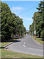
The Broadway in Stourbridge, Dudley
From the junction with Greyhound Lane, and looking north-east towards Norton, in Stourbridge.
Image: © Roger Kidd
Taken: 7 Aug 2020
0.01 miles
3
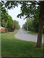
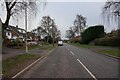
The Broadway
The view from the junction with Greyhound Lane.
Image: © Gordon Griffiths
Taken: 27 Apr 2007
0.02 miles
5
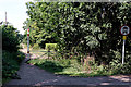
Roman Road aka Sandy Lane near Norton in Stourbridge
Looking north from near High Lodge Farm.
Roman Road is also called Sandy Lane, and is not actually Roman in origin. It was constructed in the 18th century as part of a turnpike (toll) road linking Kidderminster and Dudley. (information - K. James, BSc). It remains here as an unsurfaced wide footpath.
The course of a former Roman Road between Droitwich and Greensforge is about forty metres off to the left, on a slightly different bearing.
Image: © Roger Kidd
Taken: 7 Aug 2020
0.03 miles
7
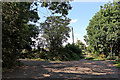
Roman Road near Norton in Stourbridge, Dudley
Looking north from near the junction with The Broadway. The track to the left leads to High Lodge Farm and Abele View Care Home (formerly High Lodge).
The route is also called Sandy Lane, and is not actually Roman in origin. It was constructed in the 18th century as part of a turnpike (toll) road linking Kidderminster and Dudley. (information - K. James, BSc).
The course of a former Roman Road between Droitwich and Greensforge is about forty metres off to the left, on a slightly different bearing.
Image: © Roger Kidd
Taken: 7 Aug 2020
0.04 miles
8
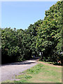
Roman Road aka Sandy Lane near Norton, Stourbridge
Looking north from near the junction with The Broadway.
The route is not actually Roman in origin. It was constructed in the 18th century as part of a turnpike (toll) road linking Kidderminster and Dudley (information - K. James, BSc).
The course of a former Roman Road between Droitwich and Greensforge is just a few metres off to the left, on a slightly different bearing.
Image: © Roger Kidd
Taken: 7 Aug 2020
0.04 miles
9
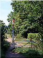
Sandy Lane aka Roman Road near Norton in Stourbridge
Looking north from near High Lodge Farm.
Roman Road is also called Sandy Lane, and is not actually Roman in origin. It was constructed in the 18th century as part of a turnpike (toll) road linking Kidderminster and Dudley. (information - K. James, BSc). It remains here as an unsurfaced wide footpath.
The course of a former Roman Road between Droitwich and Greensforge is about forty metres off to the left, on a slightly different bearing.
Image: © Roger Kidd
Taken: 7 Aug 2020
0.04 miles
10
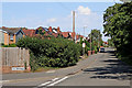
Greyhound Lane in Norton, Stourbridge
From the junction with The Broadway, and looking east-north-east towards the A451 Norton Road.
Despite the confusing placement of the road marker, this IS Greyhound Lane.
Image: © Roger Kidd
Taken: 7 Aug 2020
0.05 miles