IMAGES TAKEN NEAR TO
Glenelg Drive, STOURBRIDGE, DY8 2PF
Introduction
This page details the photographs taken nearby to Glenelg Drive, DY8 2PF by members of the Geograph project.
The Geograph project started in 2005 with the aim of publishing, organising and preserving representative images for every square kilometre of Great Britain, Ireland and the Isle of Man.

There are currently over 7.5m images from over14,400 individuals and you can help contribute to the project by visiting https://www.geograph.org.uk
Image Map
Images are licensed for reuse under creativecommons.org/licenses/by-sa/2.0
Notes
- Clicking on the map will re-center to the selected point.
- The higher the marker number, the further away the image location is from the centre of the postcode.
Image Listing (31 Images Found)
Images are licensed for reuse under creativecommons.org/licenses/by-sa/2.0
Image
Details
Distance
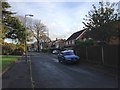
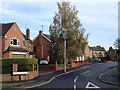
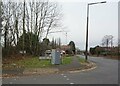
2
Worcester Lane View
The B4187 at Old Swinford near Stourbridge Dudley.
Image: © Gordon Griffiths
Taken: 27 Aug 2011
0.08 miles
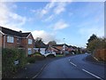
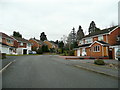
5
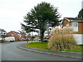
Portland Drive, Pedmore 1
Suburbia in 1970's style.
Image: © Jonathan Billinger
Taken: 22 Mar 2010
0.12 miles
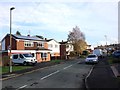
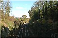
7
Traffic on A491 Hagley Road, Stourbridge, crossing the railway bridge
Bridge over the Stourbridge to Kidderminster railway, the parapets hardly noticeable.
Image: © Martin Fisher
Taken: 29 Mar 2007
0.13 miles
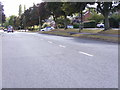
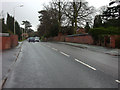
9
Worcester Lane from Racecourse Lane, Stourbridge
Image: © Ian S
Taken: 18 Dec 2021
0.15 miles
10
Portland Drive, Pedmore 2
Looking south, uphill, towards Redlake Road.
Image: © Jonathan Billinger
Taken: 22 Mar 2010
0.15 miles