IMAGES TAKEN NEAR TO
Scotts Road, STOURBRIDGE, DY8 1XE
Introduction
This page details the photographs taken nearby to Scotts Road, DY8 1XE by members of the Geograph project.
The Geograph project started in 2005 with the aim of publishing, organising and preserving representative images for every square kilometre of Great Britain, Ireland and the Isle of Man.

There are currently over 7.5m images from over14,400 individuals and you can help contribute to the project by visiting https://www.geograph.org.uk
Image Map (Loading...)


Getting Data...Please wait
Leaflet Map data © OpenStreetMap
Images are licensed for reuse under creativecommons.org/licenses/by-sa/2.0
Notes
- Clicking on the map will re-center to the selected point.
- The higher the marker number, the further away the image location is from the centre of the postcode.
Image Listing (205 Images Found)
Images are licensed for reuse under creativecommons.org/licenses/by-sa/2.0
Image
Details
Distance
1

Scott's Road play space notice, Scott's Road, Wollaston, Stourbridge
Image: © P L Chadwick
Taken: 16 Oct 2011
0.02 miles
2
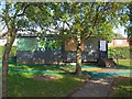
Hut in Scott's Road play space, Scott's Road, Wollaston, Stourbridge
Image: © P L Chadwick
Taken: 16 Oct 2011
0.03 miles
3
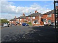
Scott's Road, Wollaston, Stourbridge
A mainly residential road.
Image: © P L Chadwick
Taken: 16 Oct 2011
0.04 miles
4
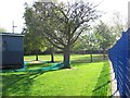
Scott's Road play space, Scott's Road, Wollaston, Stourbridge
Image: © P L Chadwick
Taken: 16 Oct 2011
0.05 miles
5
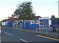
Stourbridge Children & Families Centre & Dudley Young Carers Project, Forge Road, Stourbridge
The centre offers a range of support services to children, their parents and to young people with caring responsibilities.
Image: © P L Chadwick
Taken: 16 Oct 2011
0.05 miles
6
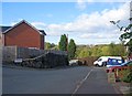
Scott's Road, Wollaston, Stourbridge
At the end of the road is the footpath leading down to Bradley Road. On the left is part of Forge Road.
Image
Image
Image: © P L Chadwick
Taken: 16 Oct 2011
0.06 miles
7
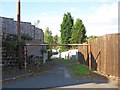
End of Scott's Road, Wollaston, Stourbridge
This is the end of Scott's Road, and the start of the path down to Bradley Road.
Image
Image: © P L Chadwick
Taken: 16 Oct 2011
0.06 miles
8
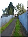
Footpath from Bradley Road to Scott's Road & Forge Road, Stourbridge
The footpath ascends to give access to Scott's Road and Forge Road.
Image: © P L Chadwick
Taken: 16 Oct 2011
0.07 miles
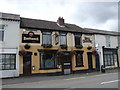
10
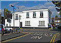
The Stourbridge Royal British Legion Club (1), 102-104 Enville Street, Stourbridge
The club is located on the corner of Enville Street and Forge Road, with the main entrance from the latter road.
Image
Image: © P L Chadwick
Taken: 16 Oct 2011
0.08 miles