
IMAGES TAKEN NEAR TO
Red Hill, STOURBRIDGE, DY8 1ND
Introduction
This page details the photographs taken nearby to Red Hill, DY8 1ND by members of the Geograph project.
The Geograph project started in 2005 with the aim of publishing, organising and preserving representative images for every square kilometre of Great Britain, Ireland and the Isle of Man.

There are currently over 7.5m images from over14,400 individuals and you can help contribute to the project by visiting https://www.geograph.org.uk
Image Map
Images are licensed for reuse under creativecommons.org/licenses/by-sa/2.0
Notes
- Clicking on the map will re-center to the selected point.
- The higher the marker number, the further away the image location is from the centre of the postcode.
Image Listing (109 Images Found)
Images are licensed for reuse under creativecommons.org/licenses/by-sa/2.0
Image
Details
Distance
4
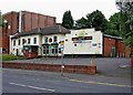
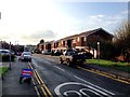
The former Stourbridge Labour Club, 31-33 Hagley Road
These large premises were the home of the Stourbridge Labour Club & Institute Limited, but are now up for sale.
Image: © P L Chadwick
Taken: 28 Jun 2009
0.10 miles
6
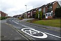
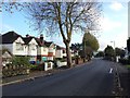
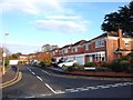
Houses on Cranbourne Road
Houses on Cranbourne Road, off Hagley Road.
Image: © Philip Halling
Taken: 4 Mar 2022
0.12 miles
7
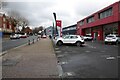
The Hagley Road
The Hagley Road passing the KIA dealership in Stourport.
Image: © Philip Halling
Taken: 4 Mar 2022
0.13 miles
8
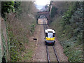
People Mover descending the branch line
The single-car shuttle unit that now operates the Stourbridge Junction to Stourbridge Town branch (less than a mile long) is the experimental Parry People Mover. So far, this is the only National Rail line on which they are used. Here it is seen descending the steeply graded branch towards the Town station. See from Parkfield Road bridge.
Image: © Stephen Craven
Taken: 7 Feb 2015
0.13 miles
10
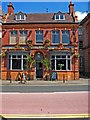
The Swan, 5 Hagley Road
Not far from Stourbridge's terrifying ring road is this popular pub with restaurant. It is on Hagley Road, which is also part of the A491.
Image
Image: © P L Chadwick
Taken: 25 Jun 2010
0.15 miles