
IMAGES TAKEN NEAR TO
Parkfield Road, STOURBRIDGE, DY8 1EZ
Introduction
This page details the photographs taken nearby to Parkfield Road, DY8 1EZ by members of the Geograph project.
The Geograph project started in 2005 with the aim of publishing, organising and preserving representative images for every square kilometre of Great Britain, Ireland and the Isle of Man.

There are currently over 7.5m images from over14,400 individuals and you can help contribute to the project by visiting https://www.geograph.org.uk
Image Map
Images are licensed for reuse under creativecommons.org/licenses/by-sa/2.0
Notes
- Clicking on the map will re-center to the selected point.
- The higher the marker number, the further away the image location is from the centre of the postcode.
Image Listing (102 Images Found)
Images are licensed for reuse under creativecommons.org/licenses/by-sa/2.0
Image
Details
Distance
3
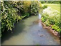
The River Stour
Taken from a footbridge not far from Stourbridge Viaduct.
Image: © Stephen Rogerson
Taken: 24 May 2012
0.12 miles
5
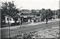
Atlas Garage (1959), Birmingham Street, Stourbridge - 1
I lived at this garage from 1958 to 1963, where my father was employed as Manager.
The garage was part of the National Benzole chain, which in turn was part of the Shell-BP group.
At the time of this and the linked photographs, the National Benzole Mr Mercury logo was of the old style ... a more modern Mr Mercury was introduced in the late 1959 / early 1960 period.
Behind the garage building, the pointed roof of the building situated behind and below the garage can be seen. I believe this to have been Bedcote Mill. Whilst I lived there, the mill was used to produce wooden articles, including (I believe) handles for Betterware products. The building has now been demolished.
To the left of the garage was Simmonds Engineering ...and its sign and gate can be seen.
The River Stour was immediately behind the garage and mill ... and I recall that at one point it overflowed and flooded the mill yard with some of the stacked logs floating away (but probably not very far!)
There were houses opposite the garage, built on and behind an earth and grass bank ... and this picture is taken from the banking, which, as can be seen, was quite bare ... today the grass and trees are much more prominent.
For a view in 2006 ... see ...
Image
For more 1959 views ... see ...
Image
Image
Image
Image
Image
Image: © Terry Robinson
Taken: Unknown
0.13 miles
6
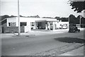
Atlas Garage (1959), Birmingham Street, Stourbridge - 5
For full details ... see ...
Image
For a view in 2006 ... see ...
Image
For more 1959 views ... see ...
Image
Image
Image
Image
Image: © Terry Robinson
Taken: Unknown
0.13 miles
7
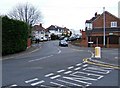
Parkfield Road
The road straight ahead is Parkfield Road. As it turns to the viewer's left it becomes Vauxhall Road.
Image: © P L Chadwick
Taken: 13 Mar 2009
0.14 miles
9
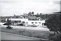
Atlas Garage (1959), Birmingham Street, Stourbridge - 2
For full details see ...
Image
This view shows Bedcote Mill more clearly ... which was immediately behind and below the garage.
One of the Gas Companies Gasometers can be seen on the horizon.
For a view in 2006 ... see ...
Image
For more 1959 views ... see ...
Image
Image
Image
Image
Image: © Terry Robinson
Taken: Unknown
0.14 miles
10
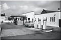
Atlas Garage (1959), Birmingham Street, Stourbridge - 3
For full details ... see ...
Image
Note the advertising poster for Super National petrol.
For a view in 2006 ... see ...
Image
For more 1959 views ... see ...
Image
Image
Image
Image
Image: © Terry Robinson
Taken: Unknown
0.14 miles