
IMAGES TAKEN NEAR TO
Lower High Street, STOURBRIDGE, DY8 1ES
Introduction
This page details the photographs taken nearby to Lower High Street, DY8 1ES by members of the Geograph project.
The Geograph project started in 2005 with the aim of publishing, organising and preserving representative images for every square kilometre of Great Britain, Ireland and the Isle of Man.

There are currently over 7.5m images from over14,400 individuals and you can help contribute to the project by visiting https://www.geograph.org.uk
Image Map
Images are licensed for reuse under creativecommons.org/licenses/by-sa/2.0
Notes
- Clicking on the map will re-center to the selected point.
- The higher the marker number, the further away the image location is from the centre of the postcode.
Image Listing (194 Images Found)
Images are licensed for reuse under creativecommons.org/licenses/by-sa/2.0
Image
Details
Distance
1
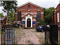
Stourbridge Unitarian Church
The building, in Lower High Street, was constructed in 1788 as a Presbyterian church, on a site that had already been used for worship for ninety years. https://www.worcesteranddudleyhistoricchurches.org.uk/index.php?page=stourbridge-unitarian-church
Image: © A J Paxton
Taken: 15 Jul 2017
0.02 miles
2
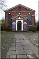
The Unitarian Chapel
This building dates from 1788 and is Grade II listed https://historicengland.org.uk/listing/the-list/list-entry/1343195?section=official-list-entry as a Presbyterian Chapel, as does Pevsner, but clearly from the signage it is an Unitarian Chapel today.
Image: © Philip Halling
Taken: 4 Mar 2022
0.02 miles
5
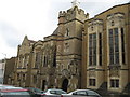
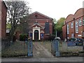
King Edward VI College, Stourbridge
The college's Charter was granted by King Edward VI in 1552. However, a school has stood on the present site since the mid-15th century.
Image: © Richard Rogerson
Taken: 14 Mar 2010
0.04 miles
6
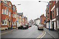
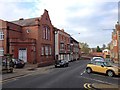
Lower High Street, Stourbridge
Once the major street through the town, it has now been cut off by the ring road, and is much quieter for traffic.
Image: © Bill Boaden
Taken: 2 Jan 2016
0.04 miles
8
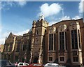
Seat of Learning.
A Royal Charter of 1552 established the King Edward VI Grammar School in Stourbridge.(Left).
Later it became part of the King Edward VI College
and recent addition (Right).
Image: © David M Lear
Taken: 23 May 2005
0.04 miles
9
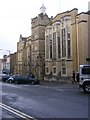
King Edward VI College
The sixth form college for Dudley borough established in 1976. The former Boys Grammar School from 1552 stands in Lower High Street, Stourbridge.
Image: © Gordon Griffiths
Taken: 28 Aug 2010
0.04 miles
10
A451 Bath Road Stourbridge Showing Road Sign
Image: © Roy Hughes
Taken: 1 Nov 2014
0.05 miles