
IMAGES TAKEN NEAR TO
Horse Bridge Lane, STOURBRIDGE, DY7 6NY
Introduction
This page details the photographs taken nearby to Horse Bridge Lane, DY7 6NY by members of the Geograph project.
The Geograph project started in 2005 with the aim of publishing, organising and preserving representative images for every square kilometre of Great Britain, Ireland and the Isle of Man.

There are currently over 7.5m images from over14,400 individuals and you can help contribute to the project by visiting https://www.geograph.org.uk
Image Map
Images are licensed for reuse under creativecommons.org/licenses/by-sa/2.0
Notes
- Clicking on the map will re-center to the selected point.
- The higher the marker number, the further away the image location is from the centre of the postcode.
Image Listing (91 Images Found)
Images are licensed for reuse under creativecommons.org/licenses/by-sa/2.0
Image
Details
Distance
1
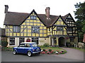
The Whittington Inn, near Kinver
The Whittington is a Grade I listed building dating back to the 14th century. It was once the home of Sir William de Whittington, grandfather of legendary Lord Mayor of London Dick Whittington. It is also said that King Charles II took refuge in the building following the Battle of Worcester. Queen Anne also spent a night there in 1711, and the solid oak front door holds one of only two her Royal seals in the country. The house became the Whittington Inn in 1788 when Lord Stamford transferred the licence – and the pub sign – from a smaller building a few hundred yards away
Image: © Richard Rogerson
Taken: 18 Jul 2010
0.07 miles
2

The Manor House of Whittington
Formerly the Whittington Inn.
Image: © JThomas
Taken: 8 Jun 2019
0.08 miles
3

The Whittington Inn
Dating from 1310, the front entrance to the Whittington Inn, South Staffordshire.
Image: © Peter Evans
Taken: 20 Aug 2014
0.08 miles
4
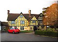
Whittington Inn, Whittington near Kinver
There are a number of conflicting claims about the history of this building which make it difficult to sort the truth from the myths. It clearly is a very old building, which many sources say was built in 1310 by Sir William de Whittington. He is said to be the grandfather of the famous Dick Whittington, Lord Mayor of London. The latter was born in the Forest of Dean in Gloucestershire, but his family did come from the Kinver area of Staffordshire, so the connection may be correct.
English Heritage say the building was originally a timber framed open hall house built in the late 14th-15th century and rebuilt in the late 16th century. Subsequently the building was extended and altered at various periods. It use as an inn commenced in 1783, according to English Heritage, but other sources give 1788. The inn is now a Marston's pub. Interestingly when it was owned by Wolverhampton & Dudley Breweries, extensive restoration was carried out in 1999, this was after the date of the English Heritage document. The restoration uncovered the remains of an early 14th century cruck-framed hall, which does tie in rather nicely with the suggested date of 1310.
Today the pub retains a fascinating interior, with a real historical ambiance and offers good food too!
Image: © P L Chadwick
Taken: 21 Apr 2012
0.08 miles
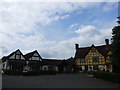
6
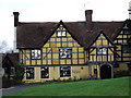
The Whittington Inn
It was built in 1310 by Sir William Whittington (the grandfather of Dick Whittington).
Image: © john shepherd
Taken: 14 Dec 2006
0.08 miles
7

Sign for the Manor House of Whittington
See Image] for context.
Image: © JThomas
Taken: 8 Jun 2019
0.09 miles

9

Footpath to Whittington in Staffordshire
The public footpath from Dunsley leads southwards with the Staffordshire and Worcestershire Canal off to the right. Some sheep are grazing nearby.
Image: © Roger Kidd
Taken: 24 Jun 2013
0.09 miles
10

Old Milepost, A449, Whittington, Parish of Kinver
The milestone is located on the west side of road, about 75 metres North of the public house car park, in the hedge. Cast iron post, Lathe iron casting, erected by the County Council in the 19th/20th century.
See https://www.geograph.org.uk/photo/6068686 for photo taken soon after restoration.
Inscription reads:- WALL HEATH 4¼ / WOMBOURNE 6¾ / WOLVERHAMPTON / 11 : : KINVER : : KIDDERMINSTER / 4¾
Maker:- Chas. Lathe, Tipton.
Staffordshire HER listed, HER Number: 51293 https://www.heritagegateway.org.uk/Gateway/Results_Single.aspx?uid=MST12513&resourceID=1010
Milestone Society National ID: ST_WVKD11
Image: © Jan Scrine
Taken: 5 May 2021
0.10 miles