
IMAGES TAKEN NEAR TO
Hawthorne Way, STOURBRIDGE, DY7 6JW
Introduction
This page details the photographs taken nearby to Hawthorne Way, DY7 6JW by members of the Geograph project.
The Geograph project started in 2005 with the aim of publishing, organising and preserving representative images for every square kilometre of Great Britain, Ireland and the Isle of Man.

There are currently over 7.5m images from over14,400 individuals and you can help contribute to the project by visiting https://www.geograph.org.uk
Image Map
Images are licensed for reuse under creativecommons.org/licenses/by-sa/2.0
Notes
- Clicking on the map will re-center to the selected point.
- The higher the marker number, the further away the image location is from the centre of the postcode.
Image Listing (220 Images Found)
Images are licensed for reuse under creativecommons.org/licenses/by-sa/2.0
Image
Details
Distance


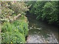
4

River Stour, Kinver, Staffs
The River Stour viewed from Mill Lane.
Image: © P L Chadwick
Taken: 9 Oct 2019
0.12 miles
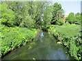
6

Grammar School Plaque
The plaque on the front of the former school house in Dark Lane Kinver. See Image
Image: © Gordon Griffiths
Taken: 18 Feb 2011
0.14 miles
7

Half-timbered house in Kinver
On the hill to the south of the village, and at the foot of Dark Lane.
Image: © Bill Boaden
Taken: 14 Sep 2018
0.14 miles
8

The Old Grammar School House, 1 Dark Lane, Kinver
Grade II Listed 16th century house incorporating earlier fragments. Extended in the 1830s and restored in 1975. A school had been founded in Kinver in 1511 and a school house had been provided by 1555 . A link between this house and The Old Grammar School has not been conclusively proven. However Rockmount, a little way to the east, is known to have been built east of the school in 1624. Pevsner mentions it only in passing. Dissolved by Edward VI the school was re-endowed without a Charter and by 1558 there is a reference to a schoolmaster by the name of John Cole. George Wharton, made schoolmaster in 1834, increased the size of the school to 50 pupils. Girls were admitted in 1901 but its fortune was waning and after the death of the schoolmaster in 1913 the school was ordered closed in 1915.
Image: © Jo and Steve Turner
Taken: 2 Apr 2011
0.14 miles

10

River Stour, Kinver, Staffs
The River Stour viewed from Mill Lane.
Image: © P L Chadwick
Taken: 9 Oct 2019
0.14 miles