
IMAGES TAKEN NEAR TO
The Grazings, STOURBRIDGE, DY7 6JH
Introduction
This page details the photographs taken nearby to The Grazings, DY7 6JH by members of the Geograph project.
The Geograph project started in 2005 with the aim of publishing, organising and preserving representative images for every square kilometre of Great Britain, Ireland and the Isle of Man.

There are currently over 7.5m images from over14,400 individuals and you can help contribute to the project by visiting https://www.geograph.org.uk
Image Map
Images are licensed for reuse under creativecommons.org/licenses/by-sa/2.0
Notes
- Clicking on the map will re-center to the selected point.
- The higher the marker number, the further away the image location is from the centre of the postcode.
Image Listing (97 Images Found)
Images are licensed for reuse under creativecommons.org/licenses/by-sa/2.0
Image
Details
Distance
1

River Stour near Whittington in Staffordshire
Looking north (upstream) from the bridge in Horse Bridge Lane.
Image: © Roger Kidd
Taken: 24 Jun 2013
0.06 miles
2

River Stour near Whittington in Staffordshire
Looking north (upstream) from the bridge in Horse Bridge Lane.
Image: © Roger Kidd
Taken: 24 Jun 2013
0.07 miles
3
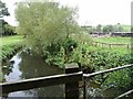
River View
The view of the River Stour from the bridleway which links Horse Bridge Road with Dark Lane, in Whittington.
Image: © Gordon Griffiths
Taken: 10 Sep 2020
0.09 miles
4

Footpath to Dunsley in Staffordshire
The public footpath leads northwards with the Staffordshire and Worcestershire Canal on the left. Narrowboat 'Rome' has moved since earlier this afternoon! Some sheep are grazing nearby. https://www.geograph.org.uk/photo/6651507
Image: © Roger Kidd
Taken: 24 Jun 2013
0.09 miles
5

Narrowboat near Whittington in Staffordshire
This is on the Staffordshire and Worcestershire Canal north of Whittington Horse Bridge. Narrowboat 'Rome' has moved since earlier this afternoon! https://www.geograph.org.uk/photo/6651507
The story of 'Rome': http://www.lockside-antiques.co.uk/Narrowboat.html
Image: © Roger Kidd
Taken: 24 Jun 2013
0.09 miles
6
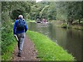
Passing By
The view on the Staffordshire & Worcestershire Canal north of the Whittington Horse Bridge near Kinver.
Image: © Gordon Griffiths
Taken: 10 Sep 2020
0.09 miles
7
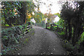
Bridge over the River Stour
Part of a bridleway which links Horse Bridge Road with Dark Lane, but it is not open to vehicles.
Image: © Bill Boaden
Taken: 14 Sep 2018
0.10 miles
8

Footpath to Dunsley in Staffordshire
The public footpath leads northwards with the Staffordshire and Worcestershire Canal off to the left. Sheep are grazing nearby.
Image: © Roger Kidd
Taken: 24 Jun 2013
0.10 miles
9
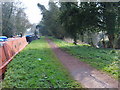
Path between River and Canal
The Towpath of the Staffordshire and Worcestershire Canal Passes close to the River Stour near Kinver.
Image: © Gordon Griffiths
Taken: 31 Mar 2007
0.11 miles
10

Houses in Dark Lane, seen across field
The footpath crosses the field to a gate in front of the white garage.
Image: © David Martin
Taken: 1 Aug 2022
0.11 miles