
IMAGES TAKEN NEAR TO
Forest Drive, STOURBRIDGE, DY7 6DX
Introduction
This page details the photographs taken nearby to Forest Drive, DY7 6DX by members of the Geograph project.
The Geograph project started in 2005 with the aim of publishing, organising and preserving representative images for every square kilometre of Great Britain, Ireland and the Isle of Man.

There are currently over 7.5m images from over14,400 individuals and you can help contribute to the project by visiting https://www.geograph.org.uk
Image Map
Images are licensed for reuse under creativecommons.org/licenses/by-sa/2.0
Notes
- Clicking on the map will re-center to the selected point.
- The higher the marker number, the further away the image location is from the centre of the postcode.
Image Listing (90 Images Found)
Images are licensed for reuse under creativecommons.org/licenses/by-sa/2.0
Image
Details
Distance
1
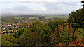
View east from Kinver Edge in Staffordshire
This is the view from Kinver Edge, looking a little north of east, across Kinver and the Stour valley. Just above the centre of the image are some large dark truncated conifers which are by Dunsley House, about a mile and a half distant. To the left and slightly closer is the housing of Dunsley.
Image: © Roger Kidd
Taken: 17 Oct 2018
0.01 miles
2
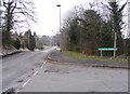
Compton Gardens View
The view up Compton Road in Kinver Village.
Image: © Gordon Griffiths
Taken: 28 Feb 2018
0.09 miles
3
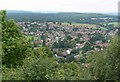
View across Kinver
Photographed from the top of Kinver Edge.
Image: © Mat Fascione
Taken: 11 Jul 2007
0.10 miles
4
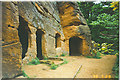
Rock Houses, Kinver Edge
Old houses for troglodytes cut into the sandstone cliffs on the west edge of Kinver village.
Image: © Colin Smith
Taken: 29 May 1996
0.13 miles
5

Waymark on Kinver Edge
This waymark indicates the way to the viewpoint, and to Holy Austin Rock. Image
Image: © P L Chadwick
Taken: 30 Jan 2010
0.15 miles
6

Gate & paths on Kinver Edge
One of the many paths from the viewpoint area on Kinver Edge passes through this gate. It forms a T junction with the path on the other side of the gate. Go north for Holy Austin Rock and southeast for the nearest car park.
Image: © P L Chadwick
Taken: 30 Jan 2010
0.15 miles
7

View from a path on Kinver Edge
Although this January day was sunny, it was very cold and there was still a lot of frost on the ground.
Image: © P L Chadwick
Taken: 30 Jan 2010
0.15 miles
8

Footpath on Kinver Edge
This footpath is on the lower slopes of Kinver Edge. As can be seen, there was a lot of frost on the ground.
Image: © P L Chadwick
Taken: 30 Jan 2010
0.15 miles
9

View down the Path
The view on Kinver Edge on a cold and snowy day.
Image: © Gordon Griffiths
Taken: 28 Feb 2018
0.16 miles
10
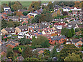
Kinver, seen from Kinver Edge in Staffordshire
This telephoto assisted image across Kinver, taken from the viewpoint on Kinver Edge, is centred on the area around Compton Gardens and the northern end of Compton Close.
Image]
Image: © Roger Kidd
Taken: 17 Oct 2018
0.16 miles