
IMAGES TAKEN NEAR TO
Edge View Close, STOURBRIDGE, DY7 6BG
Introduction
This page details the photographs taken nearby to Edge View Close, DY7 6BG by members of the Geograph project.
The Geograph project started in 2005 with the aim of publishing, organising and preserving representative images for every square kilometre of Great Britain, Ireland and the Isle of Man.

There are currently over 7.5m images from over14,400 individuals and you can help contribute to the project by visiting https://www.geograph.org.uk
Image Map
Images are licensed for reuse under creativecommons.org/licenses/by-sa/2.0
Notes
- Clicking on the map will re-center to the selected point.
- The higher the marker number, the further away the image location is from the centre of the postcode.
Image Listing (15 Images Found)
Images are licensed for reuse under creativecommons.org/licenses/by-sa/2.0
Image
Details
Distance
2
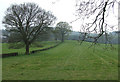
Grazing Land, Kinver, Staffordshire
Housing development is very close to surrounding, then taking this land.
Image: © Roger Kidd
Taken: 13 Apr 2007
0.16 miles
3
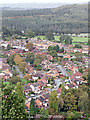
Kinver, seen from Kinver Edge in Staffordshire
This view over Kinver as seen from Kinver Edge, centres around Jenks Avenue and White Hill, and housing between there and Enville Road. Beyond that is the afforested area known as The Million.
Image: © Roger Kidd
Taken: 17 Oct 2018
0.16 miles
4
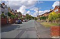
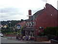
White Hill, Kinver
A mainly residential road in the Potter's Cross area of Kinver.
Image: © P L Chadwick
Taken: 22 Aug 2011
0.20 miles
6
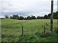
Path View
The view of the Staffs Way near Kinver Edge.
Image: © Gordon Griffiths
Taken: 8 Oct 2020
0.21 miles
7

Staffs Way
The view of the Way near the side of Kinver Edge.
Image: © Gordon Griffiths
Taken: 8 Oct 2020
0.23 miles
8

Part of Enville Road, Kinver
With a nice view downhill towards the church on its hilltop eminence on the skyline.
Image: © Jeremy Bolwell
Taken: 8 Jan 2013
0.23 miles
9
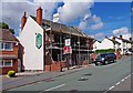
The former Crown & Anchor (1), 115A Enville Road, Kinver
Twenty five years ago, in 1986, there were ten public houses in the village of Kinver. With the closure of the Crown & Anchor, the number has halved to five. The five which have ceased trading have all been converted into or replaced with housing. The others were The Elm Tree, The New Rose & Crown (The Spring), The Old Plough, and The George & Dragon.
The Crown & Anchor was a pub for around a hundred years or more. It is shown in the 1911 census as The Crown & Anchor Inn. It is located some way from the centre of Kinver, where most tourists visit, so this probably contributed to its demise. The building has some interesting pub-related features, which I thought worth recording, as I don't know if these will be preserved during the conversion to six flats, which is currently underway.
I have placed the pub in square SO8484, as the front part of the pub, which I have photographed, is in this. The back of the building, and most of the car park, is in SO8384. The pub, when still trading, can be seen in this photo by Row17:- Image
Image
Image
Image
Image
Image: © P L Chadwick
Taken: 22 Aug 2011
0.23 miles
10
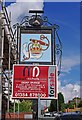
The former Crown & Anchor (2) - sign, 115A Enville Road, Kinver
The sign of this former pub currently remains, although the bottom part, containing the name, is obscured by the advertising board.
Other photos:- Image
Image: © P L Chadwick
Taken: 22 Aug 2011
0.23 miles