
IMAGES TAKEN NEAR TO
Bridgnorth Road, STOURBRIDGE, DY7 5JB
Introduction
This page details the photographs taken nearby to Bridgnorth Road, DY7 5JB by members of the Geograph project.
The Geograph project started in 2005 with the aim of publishing, organising and preserving representative images for every square kilometre of Great Britain, Ireland and the Isle of Man.

There are currently over 7.5m images from over14,400 individuals and you can help contribute to the project by visiting https://www.geograph.org.uk
Image Map
Images are licensed for reuse under creativecommons.org/licenses/by-sa/2.0
Notes
- Clicking on the map will re-center to the selected point.
- The higher the marker number, the further away the image location is from the centre of the postcode.
Image Listing (45 Images Found)
Images are licensed for reuse under creativecommons.org/licenses/by-sa/2.0
Image
Details
Distance
1
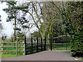
The Staffordshire Way west of Enville
Yes, the route does go through these impressive gates; use the small gate on the left and follow the fence line northwards to the corner of the field. Enville Court will be seen on the right.
Image: © Roger D Kidd
Taken: 10 Apr 2010
0.05 miles
3

The Staffordshire Way near Enville
Having followed the western fence line of Enville Court's large garden/field, the way passes through a gate to a deeply shaded track leading into the woodland of Church Gorse. The track is very muddy after prolonged rain.
Image: © Roger D Kidd
Taken: 10 Apr 2010
0.08 miles
4

The Staffordshire Way near Enville
Having followed the western fence line of Enville Court's large garden/field, the way passes through a gate to a deeply tree shaded track leading into the woodland of Church Gorse. The track is very muddy after prolonged rain.
Image: © Roger D Kidd
Taken: 10 Apr 2010
0.08 miles
5

The Staffordshire Way near Enville
Two stiles allow the Staffordshire Way to progress towards Church Gorse and Sneyd's Brook.
Image: © Roger D Kidd
Taken: 10 Apr 2010
0.11 miles
6

The Staffordshire Way near Enville
This stile (and another one) allows walkers to cross boundaries as the Staffordshire Way passes towards the western end of Church Gorse.
Image: © Roger D Kidd
Taken: 10 Apr 2010
0.11 miles
7

Field of sheep near Enville
The tower of St Mary's Church is behind.
Image: © Bill Boaden
Taken: 31 Jul 2020
0.13 miles
8

Staffordshire crop field near Enville
The Staffordshire Way long distance footpath is to the right of the fence.
Image: © Roger D Kidd
Taken: 10 Apr 2010
0.13 miles
9

The Staffordshire Way near Enville
Here, on its way towards Sneyd's Brook and Morfe Lane, the long distance footpath passes by the western end of Church Gorse.
Image: © Roger D Kidd
Taken: 10 Apr 2010
0.15 miles
10

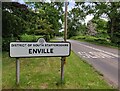
The A458 Enville
The Staffordshire Way passes down the road in Enville.
Image: © Gordon Griffiths
Taken: 25 Sep 2009
0.15 miles