
IMAGES TAKEN NEAR TO
Hall Drive, STOURBRIDGE, DY7 5HB
Introduction
This page details the photographs taken nearby to Hall Drive, DY7 5HB by members of the Geograph project.
The Geograph project started in 2005 with the aim of publishing, organising and preserving representative images for every square kilometre of Great Britain, Ireland and the Isle of Man.

There are currently over 7.5m images from over14,400 individuals and you can help contribute to the project by visiting https://www.geograph.org.uk
Image Map
Images are licensed for reuse under creativecommons.org/licenses/by-sa/2.0
Notes
- Clicking on the map will re-center to the selected point.
- The higher the marker number, the further away the image location is from the centre of the postcode.
Image Listing (97 Images Found)
Images are licensed for reuse under creativecommons.org/licenses/by-sa/2.0
Image
Details
Distance
2

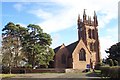
Cottage along the Staffordshire Way
On the driveway to Enville Hall.
The Staffordshire Way is 92 miles (148 km) in length. It starts at Mow Cop Castle on the edge of the Peak District in North Staffordshire, and finishes at Kinver Edge in South Staffordshire.
Image: © Mat Fascione
Taken: 29 May 2022
0.02 miles
3
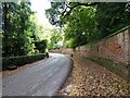
Enville Wall
The view on the drive to Enville Hall.
Image: © Gordon Griffiths
Taken: 8 Oct 2020
0.03 miles

5

Enville Estate entrance
This is an entrance to the Enville Estate, which is the major landowner around here. The entrance drive also leads to the grounds used by the local football and cricket clubs. The Enville Estate, formerly known as the Stamford Estate, is privately owned by a branch of the Grey family, amongst whose ancestors was Lady Jane Grey, who in the mid-16th century was, for a few days, the Queen of England (the "Nine Day Queen"). The Earls of Stamford, another branch of the family, used to live here, but the title became extinct on the death of the last Earl in 1976. Apart from special events, the house and grounds are not open to the public, but the estate does have holiday cottages available to rent.
Image: © P L Chadwick
Taken: 7 Aug 2010
0.08 miles
6

Utilities works at the trance to Enville Estate
See also Image for 13 years prior.
Image: © TCExplorer
Taken: 29 Mar 2023
0.10 miles
7

Gates at the entrance to the Enville Estate
Enville Hall is a country house in the Tudor/Gothic style, it is Grade II listed.
The Staffordshire Way runs along this road.
The Staffordshire Way is 92 miles (148 km) in length. It starts at Mow Cop Castle on the edge of the Peak District in North Staffordshire, and finishes at Kinver Edge in South Staffordshire.
Image: © Mat Fascione
Taken: 29 May 2022
0.10 miles

9
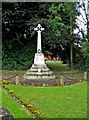
War Memorial
A simple but effective memorial in a very pleasant setting, with a flower border.
See also:- Image
Image: © P L Chadwick
Taken: 7 Aug 2010
0.11 miles
10

War Memorial - dedication
A close-up of the dedication which reads, "In grateful memory of our brothers who gave their lives in the Great War 1914-1919", followed by the names of the fallen. Quite a few memorials give this time period for the First World War, although usually these days the dates are quoted as 1914-1918. This is yet another memorial, in a very small village, which confirms the relatively large number of their young men, who were lost in the War. It must have had a terrible impact at the time, and for very many years after.
Image
Image: © P L Chadwick
Taken: 7 Aug 2010
0.11 miles