
IMAGES TAKEN NEAR TO
Greensforge Lane, STOURBRIDGE, DY7 5AX
Introduction
This page details the photographs taken nearby to Greensforge Lane, DY7 5AX by members of the Geograph project.
The Geograph project started in 2005 with the aim of publishing, organising and preserving representative images for every square kilometre of Great Britain, Ireland and the Isle of Man.

There are currently over 7.5m images from over14,400 individuals and you can help contribute to the project by visiting https://www.geograph.org.uk
Image Map
Images are licensed for reuse under creativecommons.org/licenses/by-sa/2.0
Notes
- Clicking on the map will re-center to the selected point.
- The higher the marker number, the further away the image location is from the centre of the postcode.
Image Listing (94 Images Found)
Images are licensed for reuse under creativecommons.org/licenses/by-sa/2.0
Image
Details
Distance
1

Friendly horses near Gothersley, Staffordshire
Many of the fields in this area have been divided into paddocks for use by the horse riding community. These two beauties had been grazing separately, quite calmly, when they decided on a bit of communication. Charming.
See Image]
and Image]
Image: © Roger D Kidd
Taken: 19 Apr 2011
0.07 miles
2

Horses grazing near Gothersley, Staffordshire
Many of the fields in this area have been divided into paddocks for use by the horse riding community. These two beauties had been grazing separately, quite calmly, when the bay decided to communicate with her friend. Image]
In this image they are separating to continue enjoying the warm dry conditions.
See also Image]
Image: © Roger D Kidd
Taken: 19 Apr 2011
0.07 miles
3

Grazing near Gothersley, Staffordshire
Seen from Greensforge Lane, many of the fields have been divided into paddocks so that horses can graze and have "their own space". Someone told me that horses can be cantankerous with others they do not know. These two beauties are definitely good friends, enjoying some early warm spring grazing. The Smestow River is behind the trees.
Image: © Roger D Kidd
Taken: 19 Apr 2011
0.08 miles
4

Gothersley Bridge (No 35), Staffs and Worcs Canal
Gothersley Lock can just be seen under the bridge
Image: © Richard Rogerson
Taken: 19 Jul 2010
0.08 miles
5

Greensforge Lane near Gothersley, Staffordshire
The lane to the right leads to Gothersley Lodge, by the Smestow River. Much of the land nearby is divided into paddocks for the use of horses.
Image: © Roger D Kidd
Taken: 19 Apr 2011
0.09 miles
6

Gothersley Lock and Bridge, Staffordshire and Worcestershire Canal
The Bridge is No 35 of the 109 between Stourport and Great Haywood Junction. The forty-six mile canal was opened in 1772 and cost over £100,000, James Brindley in charge.
Image: © Roger D Kidd
Taken: 12 Jan 2008
0.11 miles
7

Overflow next to Gothersley Lock No 14
Image: © Mat Fascione
Taken: 22 Apr 2016
0.12 miles
8
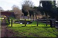
Overflow weir at Gothersley Lock, Staffs & Worcs Canal, near Ashwood, Staffs
Surplus water from the canal is taken by the weir and presumably goes into the nearby Smestow Brook.
Image
Image: © P L Chadwick
Taken: 18 Feb 2015
0.12 miles
9
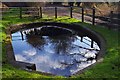
Overflow weir at Gothersley Lock, Staffs & Worcs Canal, near Ashwood, Staffs
See also:- Image
Image: © P L Chadwick
Taken: 18 Feb 2015
0.12 miles
10

Minor road by Gothersley Lock, near Ashwood, Staffs
Having crossed the Staffs & Worcs Canal by Gothersley Bridge, this road is heading for its junction with Greensforge Lane. Within the fenced area on the right is an overflow weir. To the right of the weir, but not visible in this view, is Gothersley Lock.
Image: © P L Chadwick
Taken: 18 Feb 2015
0.12 miles