
IMAGES TAKEN NEAR TO
Maidensbridge Road, KINGSWINFORD, DY6 0JD
Introduction
This page details the photographs taken nearby to Maidensbridge Road, DY6 0JD by members of the Geograph project.
The Geograph project started in 2005 with the aim of publishing, organising and preserving representative images for every square kilometre of Great Britain, Ireland and the Isle of Man.

There are currently over 7.5m images from over14,400 individuals and you can help contribute to the project by visiting https://www.geograph.org.uk
Image Map
Images are licensed for reuse under creativecommons.org/licenses/by-sa/2.0
Notes
- Clicking on the map will re-center to the selected point.
- The higher the marker number, the further away the image location is from the centre of the postcode.
Image Listing (22 Images Found)
Images are licensed for reuse under creativecommons.org/licenses/by-sa/2.0
Image
Details
Distance
1
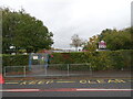
Maidensbridge Primary
The view of the School in Wall Heath, Dudley.
Image: © Gordon Griffiths
Taken: 5 Oct 2020
0.02 miles
2
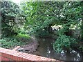
Wall Heath Stream
The view from the footpath to Kingswinford railway path on the Dudley border with Himley.
Image: © Gordon Griffiths
Taken: 5 Oct 2020
0.04 miles
3
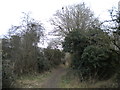
Bridleway north of Wall Heath
Looking towards Himley from just north of Maiden's Bridge.
Image: © Richard Vince
Taken: 2 Mar 2019
0.05 miles
4
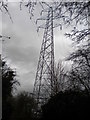
Pylon among the trees north of Wall Heath
Standing imposingly tall against a grey sky.
Image: © Richard Vince
Taken: 2 Mar 2019
0.07 miles
5
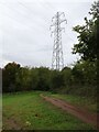
Pylon Path
The view of the footpath from Kingswinford railway path to Wall Heath.
Image: © Gordon Griffiths
Taken: 5 Oct 2020
0.08 miles
6

Farmland north of Wall Heath, Dudley
Looking east-south-east across the Holbeche Brook valley, and towards housing in Beachcroft Road, Wall Heath.
Image: © Roger D Kidd
Taken: 8 Mar 2025
0.10 miles
7

Farmland north of Wall Heath, Dudley
Looking east-south-east across the Holbeche Brook valley, and towards housing in Beachcroft Road, Wall Heath.
Image: © Roger D Kidd
Taken: 8 Mar 2025
0.10 miles
8

Farm land north of Wall Heath, Dudley
Looking east along the Holbeche Brook valley from the bridleway linking Himley with Wall Heath. The rook is the boundary between Staffordshire (left) and Dudley/Kingswinford off to the right. The whole large field off to the left between here and Himley is being considered for extensive building development of an "industrial park". There is a track all round the large field off to the left, but no right of way for the public exists to my knowledge. https://www.sstaffs.gov.uk/sites/default/files/2024-12/agt22-022-04-13_harris_lamb_for_clowes_developments_-_wall_heath_vision_doc.pdf
Image: © Roger D Kidd
Taken: 8 Mar 2025
0.12 miles
10

Farmland by Holbeche Brook near Wall Heath, Dudley
This side is still in Staffordshire, looking east towards Holbeche from the bridleway linking Wall Heath with Himley. The brook is concealed by the undergrowth. There is a track all round the large field off to the left, but no right of way for the public exists to my knowledge. The whole large field off to the left between here and Himley is being considered for extensive building development of an "industrial park". https://www.sstaffs.gov.uk/sites/default/files/2024-12/agt22-022-04-13_harris_lamb_for_clowes_developments_-_wall_heath_vision_doc.pdf
Image: © Roger D Kidd
Taken: 8 Mar 2025
0.14 miles