IMAGES TAKEN NEAR TO
Lower Valley Road, BRIERLEY HILL, DY5 3NR
Introduction
This page details the photographs taken nearby to Lower Valley Road, DY5 3NR by members of the Geograph project.
The Geograph project started in 2005 with the aim of publishing, organising and preserving representative images for every square kilometre of Great Britain, Ireland and the Isle of Man.

There are currently over 7.5m images from over14,400 individuals and you can help contribute to the project by visiting https://www.geograph.org.uk
Image Map
Images are licensed for reuse under creativecommons.org/licenses/by-sa/2.0
Notes
- Clicking on the map will re-center to the selected point.
- The higher the marker number, the further away the image location is from the centre of the postcode.
Image Listing (74 Images Found)
Images are licensed for reuse under creativecommons.org/licenses/by-sa/2.0
Image
Details
Distance
1
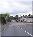
Hawbush Road
The junction with Rookery Avenue.
Image: © Gordon Griffiths
Taken: 3 Aug 2010
0.07 miles
2
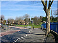
Hawbush Road near Brierley Hill, Dudley
Looking north towards the junction with Moor Street. There is extensive parkland with woodland ahead and to the right. Off to the right is Hawbush Primary School.
Image: © Roger Kidd
Taken: 4 Apr 2007
0.08 miles
3
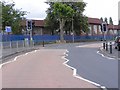
Hawbush Road School
The Primary School on Hawbush Road, Brierley Hill.
Image: © Gordon Griffiths
Taken: 3 Aug 2010
0.09 miles
4
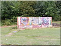
Graffiti Wall
The view from Hawbush Road of the wall in parkland next to Hawbush Primary School.
Image: © Gordon Griffiths
Taken: 3 Aug 2010
0.10 miles
5
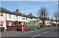
Semi-detached Houses, Hawbush Road, near Dudley
The semi-detached dwellings date from around the 1920s so there is insufficient space between them for garages or drives through to the rear. Consequently, parking is a problem.
Image: © Roger Kidd
Taken: 4 Apr 2007
0.13 miles
6
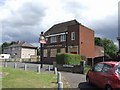
Farewell to 'The Happy Return'
I lost count of the number of boarded up pubs I saw around this area. The labour intensive industry has closed and with it the pubs.
Image: © John M
Taken: 6 Jul 2008
0.14 miles
7
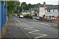
Bull Street, at the junction with Yorke Avenue
Image: © David Martin
Taken: 10 Sep 2022
0.14 miles
8
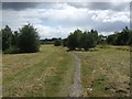
Footpath to Hawbush
Leading across former industrial land.
Image: © John M
Taken: 5 Jul 2008
0.15 miles
9
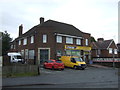
Convenience store on Moor Street, Brierley Hill
Image: © JThomas
Taken: 8 Jun 2019
0.16 miles