
IMAGES TAKEN NEAR TO
Starcrest Industrial Estate, Talbots Lane, BRIERLEY HILL, DY5 2YT
Introduction
This page details the photographs taken nearby to Starcrest Industrial Estate, Talbots Lane, DY5 2YT by members of the Geograph project.
The Geograph project started in 2005 with the aim of publishing, organising and preserving representative images for every square kilometre of Great Britain, Ireland and the Isle of Man.

There are currently over 7.5m images from over14,400 individuals and you can help contribute to the project by visiting https://www.geograph.org.uk
Image Map
Images are licensed for reuse under creativecommons.org/licenses/by-sa/2.0
Notes
- Clicking on the map will re-center to the selected point.
- The higher the marker number, the further away the image location is from the centre of the postcode.
Image Listing (107 Images Found)
Images are licensed for reuse under creativecommons.org/licenses/by-sa/2.0
Image
Details
Distance
1
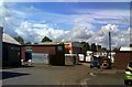
Talbots Lane View
The view in an Industrial area of Quarry Bank, Dudley.
Image: © Gordon Griffiths
Taken: 18 May 2017
0.03 miles
2
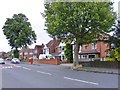
Mill Street View
The view in Brierley Hill near Dudley.
Image: © Gordon Griffiths
Taken: 10 Jun 2017
0.05 miles
3
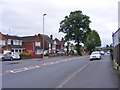
Mill Street
The view in Brierley Hill near Dudley.
Image: © Gordon Griffiths
Taken: 10 Jun 2017
0.05 miles
4
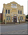
Mount Pleasant Methodist Church, Mount Pleasant, Quarry Bank, Brierley Hill near Dudley
This attractive church was originally a Wesleyan Methodist chapel and opened on Sunday the 30th November 1828. Over the years many alterations and improvements have been made.
Image: © P L Chadwick
Taken: 24 Feb 2013
0.06 miles
5
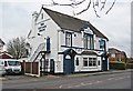
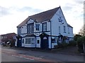
The Cottage Spring (1), 172 Mill Street, Brierley Hill near Dudley
In the 1920's and probably later there were at least eight public houses in Mill Street. Of these, along with this one, the King's Head and the Waterloo remain. Gone are the Town Arms, the Alma, the Swan, the Five Ways and the Falcon, and maybe others. Going further back in time, there were over a hundred public houses in 1860 in the central area of Brierley Hill. The number reflects the heavy industry that used to be around here. After hours of hard manual labour, workers would flock into the local pubs to drink large amounts of beer before going home.
Image
Image: © P L Chadwick
Taken: 24 Feb 2013
0.06 miles
6
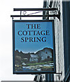
The Cottage Spring (2) - sign, 172 Mill Street, Brierley Hill near Dudley
The sign has only been up a couple of years or so. Previously there was a traditional Banks's Brewery sign with their golden lion. It no longer appears to be a Banks's house. The old sign can be seen in this April 2011 view by Stephen Rogerson:- Image
Image
Image: © P L Chadwick
Taken: 24 Feb 2013
0.06 miles
7
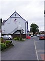
Former Pub
The Cottage Spring in Mill Street, Brierley Hill near Dudley is now a Veterinary Centre. The Pub in 2016.Image
Image: © Gordon Griffiths
Taken: 10 Jun 2017
0.07 miles
8
Delph Road Island
The view in Brierley Hill, Dudley.
Image: © Gordon Griffiths
Taken: 20 May 2017
0.07 miles
10
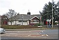
The Corn Exchange (2), Amblecote Road, Brierley Hill near Dudley
This public house has frontages to both Mount Pleasant (the A4100 road) and Amblecote Road. The latter is the postal address. This view shows the Mount Pleasant frontage.
See also:- Image
Image: © P L Chadwick
Taken: 24 Feb 2013
0.07 miles