
IMAGES TAKEN NEAR TO
Potter Court, BRIERLEY HILL, DY5 2UZ
Introduction
This page details the photographs taken nearby to Potter Court, DY5 2UZ by members of the Geograph project.
The Geograph project started in 2005 with the aim of publishing, organising and preserving representative images for every square kilometre of Great Britain, Ireland and the Isle of Man.

There are currently over 7.5m images from over14,400 individuals and you can help contribute to the project by visiting https://www.geograph.org.uk
Image Map
Images are licensed for reuse under creativecommons.org/licenses/by-sa/2.0
Notes
- Clicking on the map will re-center to the selected point.
- The higher the marker number, the further away the image location is from the centre of the postcode.
Image Listing (394 Images Found)
Images are licensed for reuse under creativecommons.org/licenses/by-sa/2.0
Image
Details
Distance
1
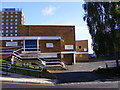
Nine Locks Youth Centre
The view in Hill Street Brierley Hill.
Image: © Gordon Griffiths
Taken: 24 Oct 2010
0.03 miles
2
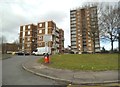
New Court View
The view of the flats off The Promenade in Brierley Hill.
Image: © Gordon Griffiths
Taken: 5 Mar 2016
0.03 miles
3
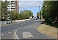
Hill Street, Brierley Hill
Heading in the direction of High Street.
Image: © Brian Clift
Taken: 24 Sep 2009
0.04 miles
4
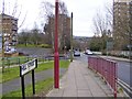
Hill Street
The view from Venture Way in Brierley Hill, Dudley.
Image: © Gordon Griffiths
Taken: 21 Feb 2016
0.04 miles
5
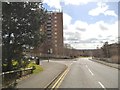
Hill Street Junction
The view of the junction with The Promenade near to Brierley Hill town.
Image: © Gordon Griffiths
Taken: 28 Mar 2016
0.05 miles
6
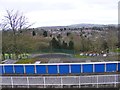
Promenade View
The view south from Brierley Hill, Dudley.
Image: © Gordon Griffiths
Taken: 21 Feb 2016
0.05 miles
7

Tower blocks near Brierley Hill, Dudley
This is a telephoto assisted image, looking north-west across the Delph Locks (Dudley No 1 Canal) from top of The Goss. The four blocks visible are all part of the Chapel Street Estate dating from the mid-late 1960s.
From left to right: Centrally is the six storey St Mary's Court then obscured by trees on the right is the similar Gifford Court. In the background on the right is the thirteen storey Briar Court, then the more distant tower mainly hidden on the left is the sixteen storey Bodmin Court. https://simonbriercliffe.com/2013/12/06/chapel-street-estate/comment-page-1/
https://simonbriercliffe.com/2013/12/06/chapel-street-estate/comment-page-1/
Image: © Roger D Kidd
Taken: 1 Apr 2025
0.05 miles
8
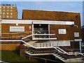
Nine Locks Community Centre
This also is used as a church called Lakeside Church.
Image: © Stephen Rogerson
Taken: 17 Feb 2011
0.06 miles
9

Chapel Street Estate tower blocks in Brierley Hill, Dudley
This telephoto assisted image, looking west-north-west across the Delph Locks (Dudley No 1 Canal), shows parts of six of the fifteen blocks on the mid-late 1960s council estate: Booth Court, Bodmin Court, Briar Court, Yeovil Court, Gifford Court, and Lowther Court. https://simonbriercliffe.com/2013/12/06/chapel-street-estate/comment-page-1/ https://ukhousing.fandom.com/wiki/Chapel_Street_estate
Image: © Roger D Kidd
Taken: 1 Apr 2025
0.06 miles
10
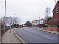
A461 Scene
The view of Venture Way in Brierley Hill, Dudley.
Image: © Gordon Griffiths
Taken: 21 Feb 2016
0.06 miles