
IMAGES TAKEN NEAR TO
Stamford Road, BRIERLEY HILL, DY5 2QF
Introduction
This page details the photographs taken nearby to Stamford Road, DY5 2QF by members of the Geograph project.
The Geograph project started in 2005 with the aim of publishing, organising and preserving representative images for every square kilometre of Great Britain, Ireland and the Isle of Man.

There are currently over 7.5m images from over14,400 individuals and you can help contribute to the project by visiting https://www.geograph.org.uk
Image Map
Images are licensed for reuse under creativecommons.org/licenses/by-sa/2.0
Notes
- Clicking on the map will re-center to the selected point.
- The higher the marker number, the further away the image location is from the centre of the postcode.
Image Listing (10 Images Found)
Images are licensed for reuse under creativecommons.org/licenses/by-sa/2.0
Image
Details
Distance
1
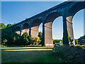
Stambermill Viaduct, Stourbridge
This railway viaduct runs across the Stour Valley; the area around here seems to be partially-open common land, and part of the River Stour banks are accessible by footpath.
Image: © Oliver Mills
Taken: 14 Aug 2022
0.19 miles
2
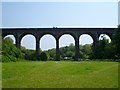
Stourbridge Viaduct
Also called Stambermill Viaduct was built in 1850.
Image: © Stephen Rogerson
Taken: 24 May 2012
0.20 miles
3
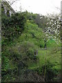
Foundations in the undergrowth.
The 1882 brick Stambermill viaduct is to the left. Dead ahead in the undergrowth are the foundations that supported two of the trestles of the 1852 wooden trestle viaduct.
Image: © Chris Allen
Taken: 27 Apr 2008
0.20 miles
4
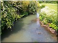
The River Stour
Taken from a footbridge not far from Stourbridge Viaduct.
Image: © Stephen Rogerson
Taken: 24 May 2012
0.21 miles
5
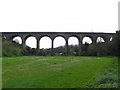
Stambermill Viaduct
A brick structure of 1882 with 10 arches that replaced a wooden trestle viaduct of 1852 that was on the far side.
Image: © Chris Allen
Taken: 27 Apr 2008
0.22 miles
7
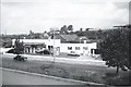
Atlas Garage (1959), Birmingham Street, Stourbridge - 2
For full details see ...
Image
This view shows Bedcote Mill more clearly ... which was immediately behind and below the garage.
One of the Gas Companies Gasometers can be seen on the horizon.
For a view in 2006 ... see ...
Image
For more 1959 views ... see ...
Image
Image
Image
Image
Image: © Terry Robinson
Taken: Unknown
0.25 miles
8
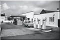
Atlas Garage (1959), Birmingham Street, Stourbridge - 3
For full details ... see ...
Image
Note the advertising poster for Super National petrol.
For a view in 2006 ... see ...
Image
For more 1959 views ... see ...
Image
Image
Image
Image
Image: © Terry Robinson
Taken: Unknown
0.25 miles
9
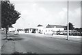
Atlas Garage (1959), Birmingham Street, Stourbridge - 4
For full details ... see ...
Image
The row of cars on the right were 'used cars for sale' ... with (I believe) a Bob Stinton in charge.
And it wasn't only cars for sale ... somewhere I have a picture showing a used Speedboat for sale.
For a view in 2006 ... see ...
Image
For more 1959 views ... see ...
Image
Image
Image
Image
Image: © Terry Robinson
Taken: Unknown
0.25 miles
10
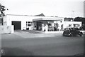
Atlas Garage (1959), Birmingham Street, Stourbridge - 6
For full details ... see ...
Image
For a view in 2006 ... see ...
Image
For more 1959 views ... see ...
Image
Image
Image
Image
Image: © Terry Robinson
Taken: Unknown
0.25 miles