IMAGES TAKEN NEAR TO
Bobs Coppice Walk, BRIERLEY HILL, DY5 2DZ
Introduction
This page details the photographs taken nearby to Bobs Coppice Walk, DY5 2DZ by members of the Geograph project.
The Geograph project started in 2005 with the aim of publishing, organising and preserving representative images for every square kilometre of Great Britain, Ireland and the Isle of Man.

There are currently over 7.5m images from over14,400 individuals and you can help contribute to the project by visiting https://www.geograph.org.uk
Image Map
Images are licensed for reuse under creativecommons.org/licenses/by-sa/2.0
Notes
- Clicking on the map will re-center to the selected point.
- The higher the marker number, the further away the image location is from the centre of the postcode.
Image Listing (4 Images Found)
Images are licensed for reuse under creativecommons.org/licenses/by-sa/2.0
Image
Details
Distance
1
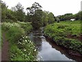
River Stour near Saltbrook Netherend
A green oasis in the industrial area of Lye and Netherend, this view is looking upstream near Saltbrook with the edge of Bob's Coppice to the left.
Image: © Kieron McMahon
Taken: 25 May 2005
0.11 miles
2
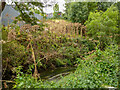
Mears Coppice, beside Dunn's Bank, Lye - With a monstrous infestation
Oh, Oh, The horrors!
Here there be an overwhelming colony of Giant Hogweed on both banks of the River Stour. I intentionally bypassed this section of riverside path, only returning to this end-section for the photograph.
If one comes across these infestations, keep away, and cower at the spectacle!
Image: © Oliver Mills
Taken: 17 Aug 2022
0.15 miles
3
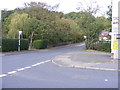
Bower Lane Junction
The view from Maypole Fields road of the bridge over the River Stour.
Image: © Gordon Griffiths
Taken: 22 Oct 2011
0.15 miles