
IMAGES TAKEN NEAR TO
Hammer Bank, BRIERLEY HILL, DY5 2AL
Introduction
This page details the photographs taken nearby to Hammer Bank, DY5 2AL by members of the Geograph project.
The Geograph project started in 2005 with the aim of publishing, organising and preserving representative images for every square kilometre of Great Britain, Ireland and the Isle of Man.

There are currently over 7.5m images from over14,400 individuals and you can help contribute to the project by visiting https://www.geograph.org.uk
Image Map
Images are licensed for reuse under creativecommons.org/licenses/by-sa/2.0
Notes
- Clicking on the map will re-center to the selected point.
- The higher the marker number, the further away the image location is from the centre of the postcode.
Image Listing (14 Images Found)
Images are licensed for reuse under creativecommons.org/licenses/by-sa/2.0
Image
Details
Distance
1
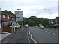
High Street, Brierley Hill
The A4100 towards Cradley Heath.
Image: © JThomas
Taken: 8 Jun 2019
0.06 miles
3
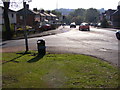
Woodland Avenue View
The view down the High Street Quarry Bank.
Image: © Gordon Griffiths
Taken: 22 Oct 2011
0.08 miles
4
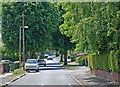
Woodlands Avenue, Quarry Bank
View in the direction of High Street.
Image: © Brian Clift
Taken: 4 Jun 2009
0.15 miles
5
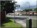
Never seen a place called this before - Cradley Heath, West Midlands
A short walk from Cradley Heath Station is the Mousesweet Brook LNR (Local Nature Reserve). It is managed by Dudley Metropolitan Borough Council. Adjoining is the Saltwells LNR, also managed by Dudley MBC. Does anyone know the origins of the Mousesweet name? Time taken 2.10 pm BST (British Summer Time).
Image: © Martin Richard Phelan
Taken: 30 Jul 2012
0.16 miles
6
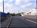
Maypole Fields
The view of a Quarry Bank road.
Image: © Gordon Griffiths
Taken: 22 Oct 2011
0.20 miles
7
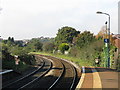
Railway line at Cradley Heath station
Looking down the gradient towards Lye.
Image: © Peter Whatley
Taken: 9 Oct 2008
0.20 miles
8
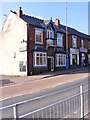
Quarry Bank Liberal Club
The view in High Street, Quarry Bank.
Image: © Gordon Griffiths
Taken: 22 Oct 2011
0.22 miles
9
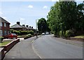
Woodlands Avenue, Quarry Bank
View in the direction of High Street.
Image: © Brian Clift
Taken: 4 Jun 2009
0.22 miles
10
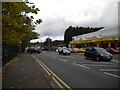
Forge Lane, Cradley Heath
Looking towards Quarry Bank and Brierley Hill, with the railway station car park behind the fence on the left.
Image: © Richard Vince
Taken: 26 Oct 2013
0.23 miles