IMAGES TAKEN NEAR TO
Stourbridge Road, BRIERLEY HILL, DY5 1JD
Introduction
This page details the photographs taken nearby to Stourbridge Road, DY5 1JD by members of the Geograph project.
The Geograph project started in 2005 with the aim of publishing, organising and preserving representative images for every square kilometre of Great Britain, Ireland and the Isle of Man.

There are currently over 7.5m images from over14,400 individuals and you can help contribute to the project by visiting https://www.geograph.org.uk
Image Map (Loading...)


Getting Data...Please wait
Leaflet Map data © OpenStreetMap
Images are licensed for reuse under creativecommons.org/licenses/by-sa/2.0
Notes
- Clicking on the map will re-center to the selected point.
- The higher the marker number, the further away the image location is from the centre of the postcode.
Image Listing (76 Images Found)
Images are licensed for reuse under creativecommons.org/licenses/by-sa/2.0
Image
Details
Distance
1
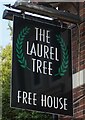
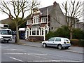
The Laurel Tree public house on Stourbridge Road, Dudley
Image: © Ian S
Taken: 3 Sep 2021
0.01 miles
4
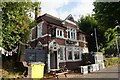
The Laurel
A Banks's (Bonks's in the local Black Country parlance) public house, beside the A461 Stourbridge Road. It's had a fresh lick of paint around the windows since Image
Image: © Richard Law
Taken: 21 Mar 2013
0.02 miles
5
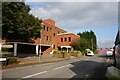
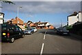
Cochrane Road, Woodside
The road as it nears its junction with Stourbridge Road.
Image: © Brian Clift
Taken: 9 Sep 2009
0.02 miles
8
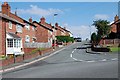
Fullwood Crescent, Woodside
View from Cochrane Road.
Image: © Brian Clift
Taken: 9 Sep 2009
0.06 miles
9
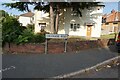
Vine Street, Harts Hill
View from Stourbridge Road.
Image: © Brian Clift
Taken: 9 Sep 2009
0.06 miles
10

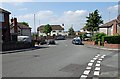
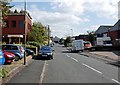
Stourbridge Road, Harts Hill
View from near the junction of Vine Street in the direction of Roand Oak.
Image: © Brian Clift
Taken: 9 Sep 2009
0.07 miles