IMAGES TAKEN NEAR TO
Woods Crescent, BRIERLEY HILL, DY5 1EG
Introduction
This page details the photographs taken nearby to Woods Crescent, DY5 1EG by members of the Geograph project.
The Geograph project started in 2005 with the aim of publishing, organising and preserving representative images for every square kilometre of Great Britain, Ireland and the Isle of Man.

There are currently over 7.5m images from over14,400 individuals and you can help contribute to the project by visiting https://www.geograph.org.uk
Image Map (Loading...)


Getting Data...Please wait
Leaflet Map data © OpenStreetMap
Images are licensed for reuse under creativecommons.org/licenses/by-sa/2.0
Notes
- Clicking on the map will re-center to the selected point.
- The higher the marker number, the further away the image location is from the centre of the postcode.
Image Listing (66 Images Found)
Images are licensed for reuse under creativecommons.org/licenses/by-sa/2.0
Image
Details
Distance
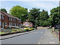
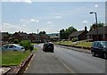
1
Woods Crescent, Quarry Bank
View from Woodlands Avenue.
Image: © Brian Clift
Taken: 4 Jun 2009
0.01 miles
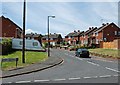
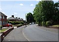
2
Woods Crescent, Quarry Bank
View from Woodlands Avenue.
Image: © Brian Clift
Taken: 4 Jun 2009
0.02 miles
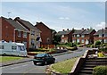
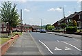
3
Woodlands Avenue, Quarry Bank
View from the junction with Charles Road.
Image: © Brian Clift
Taken: 4 Jun 2009
0.04 miles
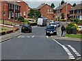
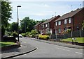
4
Woodlands Avenue, Quarry Bank
Near the junction with Charles Road.
Image: © Brian Clift
Taken: 4 Jun 2009
0.04 miles
5
Woodlands Avenue, Quarry Bank
View in the direction of High Street.
Image: © Brian Clift
Taken: 4 Jun 2009
0.06 miles
6

Charles Road, Quarry Bank
View from Woodlands Avenue.
Image: © Brian Clift
Taken: 4 Jun 2009
0.06 miles
7
Woodlands Avenue, Quarry Bank
View from Birch Coppice.
Image: © Brian Clift
Taken: 4 Jun 2009
0.07 miles
8

Charles Road, Quarry Bank
View from Woodlands Avenue.
Image: © Brian Clift
Taken: 4 Jun 2009
0.07 miles
9
Anne Road, Quarry Bank
View from Woodlands Avenue.
Image: © Brian Clift
Taken: 4 Jun 2009
0.08 miles