
IMAGES TAKEN NEAR TO
Gate Street, TIPTON, DY4 7SP
Introduction
This page details the photographs taken nearby to Gate Street, DY4 7SP by members of the Geograph project.
The Geograph project started in 2005 with the aim of publishing, organising and preserving representative images for every square kilometre of Great Britain, Ireland and the Isle of Man.

There are currently over 7.5m images from over14,400 individuals and you can help contribute to the project by visiting https://www.geograph.org.uk
Image Map
Images are licensed for reuse under creativecommons.org/licenses/by-sa/2.0
Notes
- Clicking on the map will re-center to the selected point.
- The higher the marker number, the further away the image location is from the centre of the postcode.
Image Listing (47 Images Found)
Images are licensed for reuse under creativecommons.org/licenses/by-sa/2.0
Image
Details
Distance
1
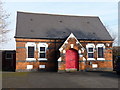
Disused Methodist Chapel, Burnt Tree
Or more accurately, it's disused as a place of worship; a firm of surveyors uses the premises as an office. The chapel lies on Hopkins Street, and was built in 1876
Image: © Richard Law
Taken: 31 Jan 2011
0.05 miles
2
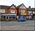
Two Tividale Road shops, Tividale
On the left is Violet Miller Florist. On the right is K2 Express Supermarket.
Image: © Jaggery
Taken: 5 May 2012
0.08 miles
3
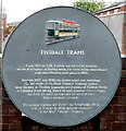
Tividale Trams plaque
Located on a wall at the Tividale Road end of Hopkins Street.
The plaque records a potted history of trams in the area. From 1885 to 1939, Tividale was served by tramcars on the Birmingham to Dudley route. The trams were steam-hauled until electrification in 1903. The tramcar illustrated is Dudley and Stourbridge No 5, built at Tividale in 1920 and now preserved at the Black Country Museum.
Image: © Jaggery
Taken: 5 May 2012
0.08 miles
4
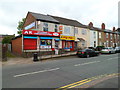
Convenience store and Village Chippy, Tividale
Viewed across Tividale Road from the corner of Gate Street.
The two shops are AK off-licence & convenience store, and Village Chippy, selling fish & chips, kebabs, pizzas, burgers, pies, southern-fried chicken, etc.
Image: © Jaggery
Taken: 5 May 2012
0.08 miles
5
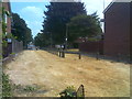
Gate Street Passage
The view off the A461 near Burnt Tree junction in Dudley.
Image: © Gordon Griffiths
Taken: 12 Jul 2018
0.10 miles
6
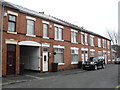
Walford Street
Victorian terraced houses with archway to rear.
Image: © Burgess Von Thunen
Taken: 21 Feb 2013
0.10 miles
7
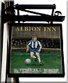
Albion Inn pub sign, Tividale
The sign shows a player in the colours of West Bromwich Albion Football Club, who
have played in navy blue and white striped shirts for most of their existence.
The pub http://www.geograph.org.uk/photo/2948532 is on the corner of Tividale Road and Danks Street.
Image: © Jaggery
Taken: 5 May 2012
0.11 miles
8
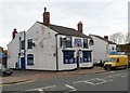
Albion Inn, Tividale
Pub on the corner of Tividale Road and Danks Street, opposite Tividale Post Office. http://www.geograph.org.uk/photo/2948499
The pub sign http://www.geograph.org.uk/photo/2948570 shows that the Albion in question is West Bromwich Albion F.C.
Image: © Jaggery
Taken: 5 May 2012
0.11 miles
9
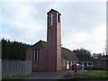
St Michael The Archangel, Tividale
Situated in Tividale Road, the church was opened in 1995, using, as a basis, the hall of the original church, which stood from 1878 to 1984
Image: © Geoff Pick
Taken: 5 Dec 2009
0.12 miles
10
Bradley Street
The view off the A461 near Burnt Tree junction in Dudley.
Image: © Gordon Griffiths
Taken: 12 Jul 2018
0.13 miles