
IMAGES TAKEN NEAR TO
Highgate Common East, DUDLEY, DY3 4QE
Introduction
This page details the photographs taken nearby to Highgate Common East, DY3 4QE by members of the Geograph project.
The Geograph project started in 2005 with the aim of publishing, organising and preserving representative images for every square kilometre of Great Britain, Ireland and the Isle of Man.

There are currently over 7.5m images from over14,400 individuals and you can help contribute to the project by visiting https://www.geograph.org.uk
Image Map
Images are licensed for reuse under creativecommons.org/licenses/by-sa/2.0
Notes
- Clicking on the map will re-center to the selected point.
- The higher the marker number, the further away the image location is from the centre of the postcode.
Image Listing (12 Images Found)
Images are licensed for reuse under creativecommons.org/licenses/by-sa/2.0
Image
Details
Distance
1
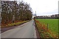
Camp Hill Road (2)
This rural road is here passing Highgate Common Country Park on the left, and land belonging to My Lady's Farm on the right. On the extreme left of the photograph is the start of the access road to one of the Country Park's car parks.
Image
Image: © P L Chadwick
Taken: 3 Jan 2011
0.02 miles
2
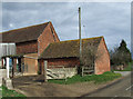
Barns at Camp Farm near Greensforge in Staffordshire
The farm also sells its own eggs, jam, and other things at the gate.
Image: © Roger Kidd
Taken: 14 Mar 2007
0.08 miles
3
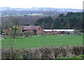
Camp Farm, near Highgate Common, Staffordshire
The woodland behind the farm is at the edge of Highgate Country Park, which is readily accessible by the public.
Image: © Roger Kidd
Taken: 14 Mar 2007
0.16 miles
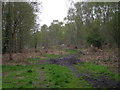
5
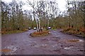
Highgate Common Country Park car park, off Camp Hill Road
This is just one of eight official car parks for the country park, which are currently open.
Image
Image: © P L Chadwick
Taken: 3 Jan 2011
0.17 miles
6
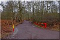
Entrance to car park access road off Camp Hill Road
This is the entrance to the access road to one of the current eight official car parks for Highgate Common Country Park. This and three others are situated off Camp Hill Road. The brightly painted access barrier can be closed, and on the day the photograph was taken, it and four others were due to be closed at around dusk.
Image
Image: © P L Chadwick
Taken: 3 Jan 2011
0.17 miles
7
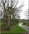
The Road to Highgate Common
Just "creeping" onto the square, the road bends round towards Camp Farm, through pastureland and patches of mixed woodland, dominated by birch trees.
Image: © Roger Kidd
Taken: 12 Mar 2007
0.22 miles
8
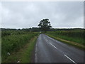
Camp Hill Road
Towards Camp Farm and Highgate Common.
Image: © JThomas
Taken: 8 Jun 2019
0.22 miles
9
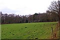
Field adjacent to Camp Hill Road
This field would appear to be part of My Lady's Farm, according to the OS Explorer Map. On the other side of the hedge, can be glimpsed some farm buildings. The archaic sounding name of the farm would seem to indicate that it was/is owned by someone titled, and is almost certainly quite an old name.
Image: © P L Chadwick
Taken: 3 Jan 2011
0.22 miles
10
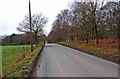
Camp Hill Road (1)
This rural road is seen passing a field of the strangely named My Lady's Farm, on the left, and the fringe of Highgate Common Country Park, on the right.
Image
Image: © P L Chadwick
Taken: 3 Jan 2011
0.24 miles