
IMAGES TAKEN NEAR TO
Chasepool Road, DUDLEY, DY3 4PA
Introduction
This page details the photographs taken nearby to Chasepool Road, DY3 4PA by members of the Geograph project.
The Geograph project started in 2005 with the aim of publishing, organising and preserving representative images for every square kilometre of Great Britain, Ireland and the Isle of Man.

There are currently over 7.5m images from over14,400 individuals and you can help contribute to the project by visiting https://www.geograph.org.uk
Image Map
Images are licensed for reuse under creativecommons.org/licenses/by-sa/2.0
Notes
- Clicking on the map will re-center to the selected point.
- The higher the marker number, the further away the image location is from the centre of the postcode.
Image Listing (78 Images Found)
Images are licensed for reuse under creativecommons.org/licenses/by-sa/2.0
Image
Details
Distance
1
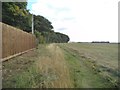
Holloway Path
The footpath from Swindon follows the field edge towards Hinksford.
Image: © Gordon Griffiths
Taken: 25 Sep 2015
0.03 miles
2
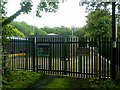
Gas Works
The view next to Swindon Rough near Swindon, Staffordshire.
Image: © Gordon Griffiths
Taken: 9 Jun 2017
0.04 miles
3
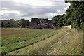
Footpath to Swindon in Staffordshire
Looking north-west, Chasepool Cottages are by The Holloway, leading into Swindon.
Image: © Roger Kidd
Taken: 24 Aug 2017
0.04 miles
4
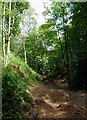
Woodland track near Swindon, Staffordshire
South-west of the village is an area of woodland known as Swindon Rough. This covers the sandstone slope leading down to a meander in the course of the Smestow Brook. This view up the slope close by The Holloway shows a track which has had several mounds of earth deposited and compacted to enhance to rocky undulating nature of the track. This is used by BMX (bicycle moto-cross) and mountain bike riders for active recreation.
Image: © Roger D Kidd
Taken: 14 Jun 2011
0.05 miles
5
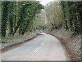
The Holloway Repairs
The view near Swindon Village in Staffordshire.
Image: © Gordon Griffiths
Taken: 18 Mar 2021
0.07 miles
6
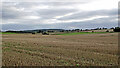
Staffordshire farmland south-west of Swindon
Looking west-north-west from the footpath by Swindon Rough.
Image: © Roger Kidd
Taken: 24 Aug 2017
0.08 miles
7
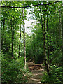
Woodland track near Swindon, Staffordshire
South-west of the village is an area of woodland known as Swindon Rough. This covers the sandstone slope leading down to a meander in the course of the Smestow Brook. This view down the slope close by The Holloway shows a track which has had several mounds of earth deposited and compacted to enhance to rocky undulating nature of the track. This is used by BMX (bicycle moto-cross) and mountain bike riders for active recreation.
Image: © Roger D Kidd
Taken: 14 Jun 2011
0.09 miles
8
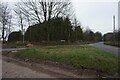
Whitehouse Lane at Chasepool Road near Swindon
Image: © Ian S
Taken: 18 Dec 2021
0.09 miles
9
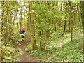
Woodland Path
The view of the Woodland track off the Holloway near Swindon, Staffordshire.
Image: © Gordon Griffiths
Taken: 30 Apr 2018
0.10 miles
10
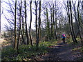
Woodland Path
The view near the Holloway in Swindon.
Image: © Gordon Griffiths
Taken: 22 Jan 2016
0.11 miles