
IMAGES TAKEN NEAR TO
Wombourne Road, DUDLEY, DY3 4NA
Introduction
This page details the photographs taken nearby to Wombourne Road, DY3 4NA by members of the Geograph project.
The Geograph project started in 2005 with the aim of publishing, organising and preserving representative images for every square kilometre of Great Britain, Ireland and the Isle of Man.

There are currently over 7.5m images from over14,400 individuals and you can help contribute to the project by visiting https://www.geograph.org.uk
Image Map
Images are licensed for reuse under creativecommons.org/licenses/by-sa/2.0
Notes
- Clicking on the map will re-center to the selected point.
- The higher the marker number, the further away the image location is from the centre of the postcode.
Image Listing (118 Images Found)
Images are licensed for reuse under creativecommons.org/licenses/by-sa/2.0
Image
Details
Distance
1
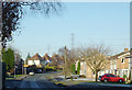
Wombourne Road at Swindon, Staffordshire
Looking north from near the Greyhound public house at the top of High Street.
Image: © Roger D Kidd
Taken: 8 Dec 2010
0.04 miles
2
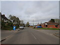
Albert Drive View
The view along the Wombourne Road in Swindon, Staffordshire.
Image: © Gordon Griffiths
Taken: 18 Mar 2021
0.05 miles
3
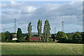
Pasture by Swindon in Staffordshire
The housing is in Wombourne Road. The footpath crossing fields has come from Botterham.
Image: © Roger Kidd
Taken: 29 Aug 2010
0.06 miles
4
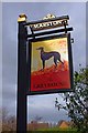
The Greyhound (2) - sign, High Street, Swindon, Staffs
A very popular name for a pub, possibly because when many people couldn't read or write, the greyhound was an easily recognised animal and thus the pub could be identified without difficulty.
Image
Image: © P L Chadwick
Taken: 22 Jan 2012
0.09 miles
5
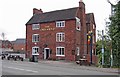
The Greyhound (1), High Street, Swindon, Staffs
One of the village's three pubs, all of which are Marston's houses. The Greyhound is a Grade II listed building, which is believed to date from the early 18th century. At the rear is a two storey extension, with a large side stack. The listing text suggests this was possibly a former brewhouse.
Image
Image
Image: © P L Chadwick
Taken: 22 Jan 2012
0.09 miles
6
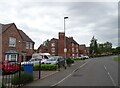
The Greyhound
The view of the former inn on Wombourne Road on the edge of Swindon village, now changed to housing.
The view in December 2006 Image
Image: © Gordon Griffiths
Taken: 10 Jun 2021
0.09 miles
7
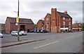
The Greyhound (3), High Street, Swindon, Staffs
Image: © P L Chadwick
Taken: 22 Jan 2012
0.10 miles
8
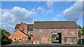
Old barn in Swindon High Street, Staffordshire
This shows the back of the old barn in High Street, Swindon. The Greyhound Inn is adjacent on the left. Both are early 18th century and Grade II listed, and are to be converted into residential accommodation (circa 2016) as part of a wider development.
https://www.lime.life/thegreyhound
Image: © Roger Kidd
Taken: 29 Aug 2010
0.10 miles
9
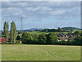
Pasture and footpath to Swindon, Staffordshire
Looking south-east, the public footpath crosses pasture between the bridleway near Botterham Bridge and Swindon village. The current path on the ground does wander a bit off the course shown on maps. The housing on the right is in Winston Road.
Image: © Roger Kidd
Taken: 29 Aug 2010
0.11 miles
10
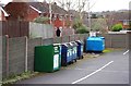
Recycling point, High Street, Swindon, Staffs
This small recycling facility is at the end of the car park belonging to the Greyhound public house.
Image: © P L Chadwick
Taken: 22 Jan 2012
0.12 miles