
IMAGES TAKEN NEAR TO
Thornleigh Trading Estate, DUDLEY, DY2 8UB
Introduction
This page details the photographs taken nearby to Thornleigh Trading Estate, DY2 8UB by members of the Geograph project.
The Geograph project started in 2005 with the aim of publishing, organising and preserving representative images for every square kilometre of Great Britain, Ireland and the Isle of Man.

There are currently over 7.5m images from over14,400 individuals and you can help contribute to the project by visiting https://www.geograph.org.uk
Image Map
Images are licensed for reuse under creativecommons.org/licenses/by-sa/2.0
Notes
- Clicking on the map will re-center to the selected point.
- The higher the marker number, the further away the image location is from the centre of the postcode.
Image Listing (127 Images Found)
Images are licensed for reuse under creativecommons.org/licenses/by-sa/2.0
Image
Details
Distance
1
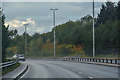
Dudley : Dudley Southern By-Pass A461
Looking along the Dudley Southern By-Pass.
Image: © Lewis Clarke
Taken: 27 Sep 2019
0.07 miles
2
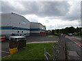
Demet Works
The view on Peartree Lane, Dudley.
Image: © Gordon Griffiths
Taken: 19 Jun 2021
0.12 miles
3
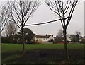
Playing Field off Clee Road
Located at the side of Clee Road. This field was once covered in black cinders and was known by local children as "The Black Oss". Football games were played there as well as a local cycle speedway team using it as their track.
Image: © Brian Clift
Taken: 6 Jan 2006
0.13 miles
4
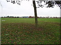
Playing Field off Clee Road
View towards Netherton. St Andrews Church can just be seen.
Image: © Brian Clift
Taken: 22 Nov 2005
0.14 miles
5
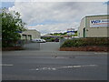
Crescent Industrial Park
The view from Peartree Lane, Dudley.
Image: © Gordon Griffiths
Taken: 19 Jun 2021
0.15 miles
6
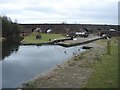
Canal Junction, Parkhead
3 Parkhead Locks lead up from Parkhead Junction of the Dudley Nos 1 and 2 Canals. At the top of the locks, and just a few yards south of Dudley Tunnel, lies this extraordinary junction. 1.25 miles of Pensnett Canal headed S and SE out of the picture to the right (some isolated sections still visible), Parkhead Top Lock lies in the centre and a couple of hundred yards of Grazebrook Arm headed leftwards and terminated just past Peartree Lane, serving, among other things, a factory which cast the casings for Barnes Wallis's dam-busting bouncing bombs. The railway viaduct in the distance was to have been converted to an embankment which would have lost the relevance of all of this industrial history except for the efforts of the volunteers who became the Dudley Canal Trust http://dudleycanaltrust.org.uk/
Image: © Martin Wilson
Taken: 3 Mar 2002
0.15 miles
7
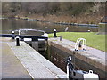
Lock View
The view of Park Head Lock on the Dudley No1 Canal.
Image: © Gordon Griffiths
Taken: 11 Dec 2010
0.15 miles
8
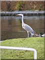
Dudley Heron
The view at Park Head Lock of Dudley No 1 Canal.
Image: © Gordon Griffiths
Taken: 11 Dec 2010
0.15 miles
9
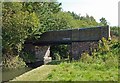
Grazebrook Arm Bridge
Bridge spanning the now disused canal arm.
Image: © Brian Clift
Taken: 9 Sep 2009
0.15 miles
10
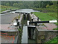
Parkhead Top Lock near Dudley
Looking north on Dudley No 1 Canal on a persistently wet day.
Ahead is Parkhead Top Lock, No 1. The Parkhead flight of three locks provides a rise (or fall) of twenty feet (just over six metres).
The tunnel has very restrictive use, so very few boats go this way. https://en.wikipedia.org/wiki/Dudley_Tunnel Off to the left is a short remnant of what was originally the Pensnett Canal.
Image: © Roger Kidd
Taken: 26 Aug 2010
0.15 miles