
IMAGES TAKEN NEAR TO
Old Buffery Gardens, DUDLEY, DY2 8TD
Introduction
This page details the photographs taken nearby to Old Buffery Gardens, DY2 8TD by members of the Geograph project.
The Geograph project started in 2005 with the aim of publishing, organising and preserving representative images for every square kilometre of Great Britain, Ireland and the Isle of Man.

There are currently over 7.5m images from over14,400 individuals and you can help contribute to the project by visiting https://www.geograph.org.uk
Image Map
Images are licensed for reuse under creativecommons.org/licenses/by-sa/2.0
Notes
- Clicking on the map will re-center to the selected point.
- The higher the marker number, the further away the image location is from the centre of the postcode.
Image Listing (63 Images Found)
Images are licensed for reuse under creativecommons.org/licenses/by-sa/2.0
Image
Details
Distance
1
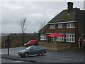
The Struggling Man
A Pub in Prospect Row.
Image: © Gordon Griffiths
Taken: 6 Dec 2007
0.03 miles
2
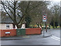
View from Paradise
View from Paradise and Prospect Row, Dixon's Green.
Image: © Gordon Griffiths
Taken: 6 Dec 2007
0.04 miles
3
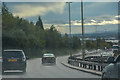
Dudley : Duncan Edwards Way A461
Looking along the Duncan Edwards Way.
Image: © Lewis Clarke
Taken: 27 Sep 2019
0.06 miles
4
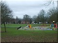
Buffery Park
The park from Prospect Row.
Image: © Gordon Griffiths
Taken: 6 Dec 2007
0.10 miles
5
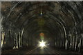
Dudley Railway Tunnel
constructed in the 1850's
Image: © David Fisher
Taken: 29 Jun 2011
0.10 miles
6
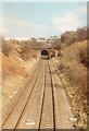
Blowers Green railway tunnel
This is the Blowers Green end of the Dudley railway tunnel, taken about a week after the line was closed to freight. The tracks are still there today but it's a bit of a job to see them through the undergrowth. The Dudley bypass now runs along the extreme right of this shot: during this visit, there was a notice warning people of its imminent construction in a kids' playground off camera to the right. There used to be a station roughly in the middle of this shot: the station building, which was remote from the platforms, still exists today, by the road bridge I'm standing on, just off camera to the left: see Brian Clift's photo at http://www.geograph.org.uk/photo/1993404
Image: © John Winder
Taken: Unknown
0.10 miles
7
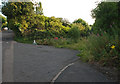
New Road, Dudley
Showing what remains of an old access road that led into the now demolished Dudley Gas Works.
Image: © Brian Clift
Taken: 25 Jul 2010
0.13 miles
8
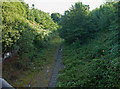
New Road, Dudley
View from the New Road railway bridge,in the direction of the Dudley Tunnel, showing the remaining tracks of the Oxford, Worcester and Wolverhampton Railway, at the site of the old Blowers Green Station.
Image: © Brian Clift
Taken: 25 Jul 2010
0.14 miles
9
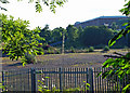
Bath Street, Dudley
View through the railings at the former site of Dudley Gas Works.
Image: © Brian Clift
Taken: 25 Jul 2010
0.14 miles
10

New Road, Dudley
Approaching the junction with Shaw Road.
Image: © Brian Clift
Taken: 25 Jul 2010
0.14 miles