IMAGES TAKEN NEAR TO
Kitchener Road, DUDLEY, DY2 7QN
Introduction
This page details the photographs taken nearby to Kitchener Road, DY2 7QN by members of the Geograph project.
The Geograph project started in 2005 with the aim of publishing, organising and preserving representative images for every square kilometre of Great Britain, Ireland and the Isle of Man.

There are currently over 7.5m images from over14,400 individuals and you can help contribute to the project by visiting https://www.geograph.org.uk
Image Map
Images are licensed for reuse under creativecommons.org/licenses/by-sa/2.0
Notes
- Clicking on the map will re-center to the selected point.
- The higher the marker number, the further away the image location is from the centre of the postcode.
Image Listing (76 Images Found)
Images are licensed for reuse under creativecommons.org/licenses/by-sa/2.0
Image
Details
Distance
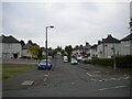
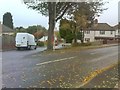
1
Mons Road
The view along the Dudley street near Burnt Tree.
Image: © Gordon Griffiths
Taken: 27 Oct 2018
0.04 miles
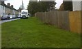
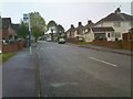
2
Kitchener Road
The view along the Dudley street near Burnt Tree.
Image: © Gordon Griffiths
Taken: 27 Oct 2018
0.05 miles
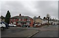
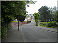
3
Highfield Road, Dudley
Seen from its junction with Corporation Road.
Image: © Richard Vince
Taken: 29 May 2021
0.05 miles
4
Mons Road View
The view in Kates Hill, Dudley.
Image: © Gordon Griffiths
Taken: 17 Nov 2022
0.05 miles
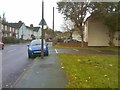
5
Haig Road
The view of the Dudley street near Burnt Tree.
Image: © Gordon Griffiths
Taken: 27 Oct 2018
0.06 miles
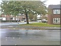
6
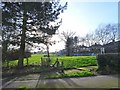
Playground View
The view from Corporation Road in Dudley.
Image: © Gordon Griffiths
Taken: 12 Feb 2020
0.07 miles
7
Bunn's Lane Scene
The view along the Dudley street near Burnt Tree.
Image: © Gordon Griffiths
Taken: 27 Oct 2018
0.07 miles
8
French Road Junction
The view of the junction with Highfield Road in Kates Hill, Dudley.
Image: © Gordon Griffiths
Taken: 17 Nov 2022
0.09 miles
9
Bunn's Lane View
The view along the Dudley street near Burnt Tree.
Image: © Gordon Griffiths
Taken: 27 Oct 2018
0.09 miles
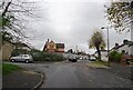
10
Corporation Road, Dudley (2)
Seen from its junction with Arras Road.
Image: © Richard Vince
Taken: 29 May 2021
0.09 miles